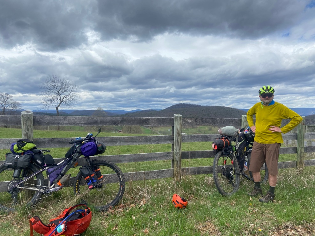
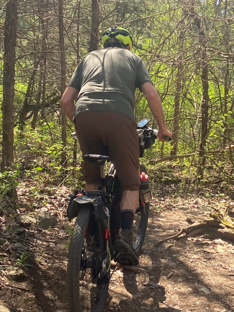
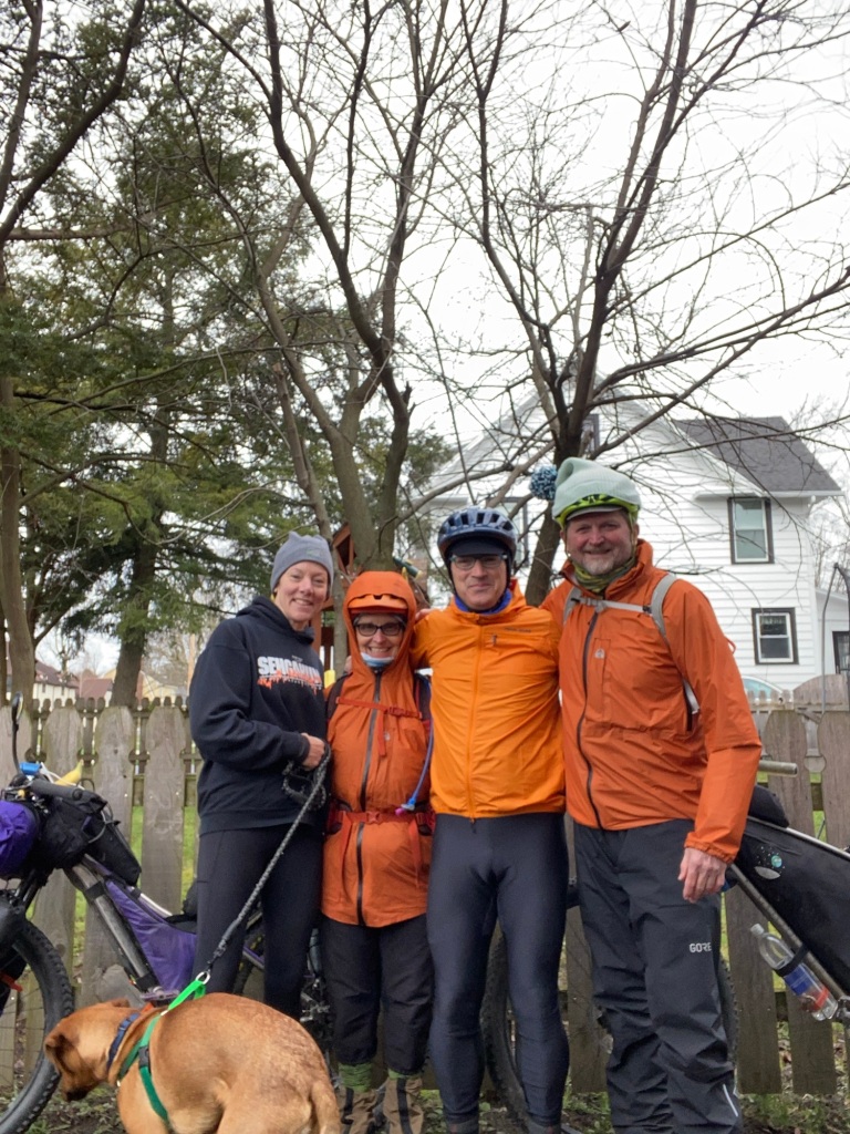
Mike and I have spent a week solid relaxing, eating, planning, mapping resources on the race course, eating, tuning bikes, swapping gear out to ride lighter, and eating more.
A week of downtime is better than being late for the race!
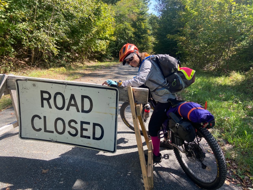
It is tough to carry what you need for an open-ended ride while also trying to switch to the bare minimum for a race. The folks at The Shenandoah Bicycle Company kept a box we shipped for our resupply and now they’ll keep another box of stuff we don’t want to carry for The RockStar but will pick up when we come back through.
We’re also shipping a box home….fingers crossed we don’t send anything we might need!
Plans are always changing….but if all goes well, we’ll each finish The RockStar trail race in Roanoke and then take a leisurely ride together in reverse on the gravel course back here to Harrisonburg, pick up our stuff stashed at the bike shop and ride the Trans VA route toward D.C.
We’re thinking of picking up the C&O Trail to the Great Allegheny Passage to ride the Trillium section we missed in PA because of the weather.
But things change so I’ll keep you posted.
Friday, Tomorrow
Pre-race meeting, last minute tweaks to the bike and hopefully a good night’s sleep!
If there was a Starship & a coffee shop when I was in college, I would’ve gone broke for sure!
Now Friday is Today
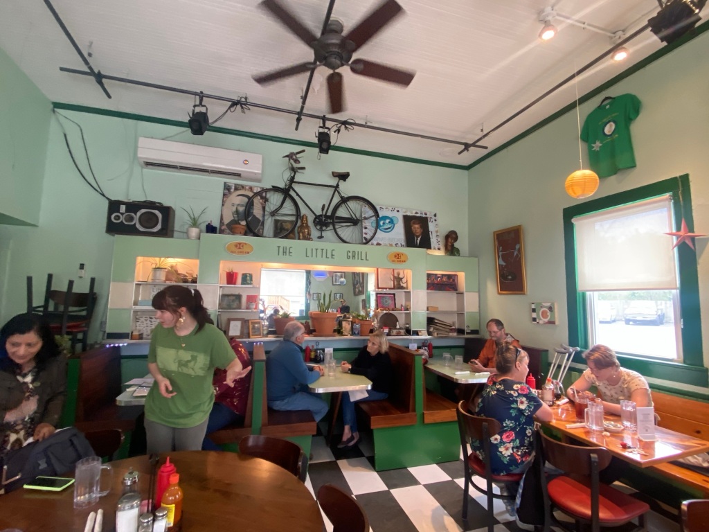
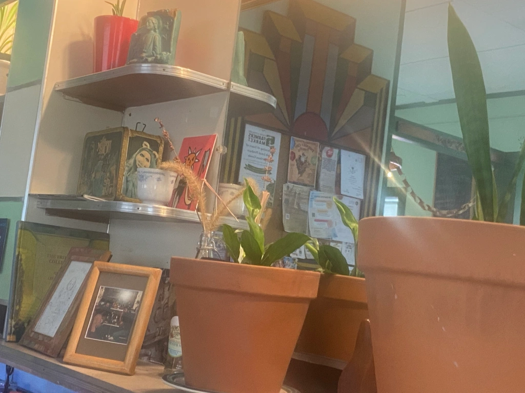
Lunch at the Little Grill. Unique decor!
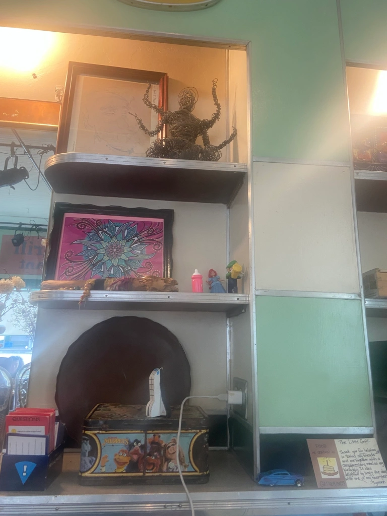
Someone’s a Muppet fan for sure!
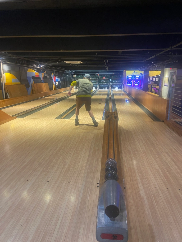
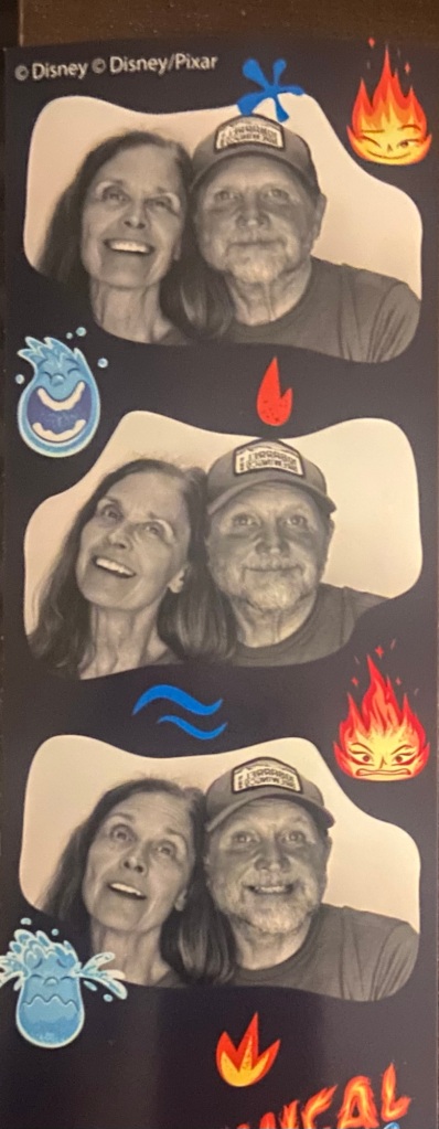
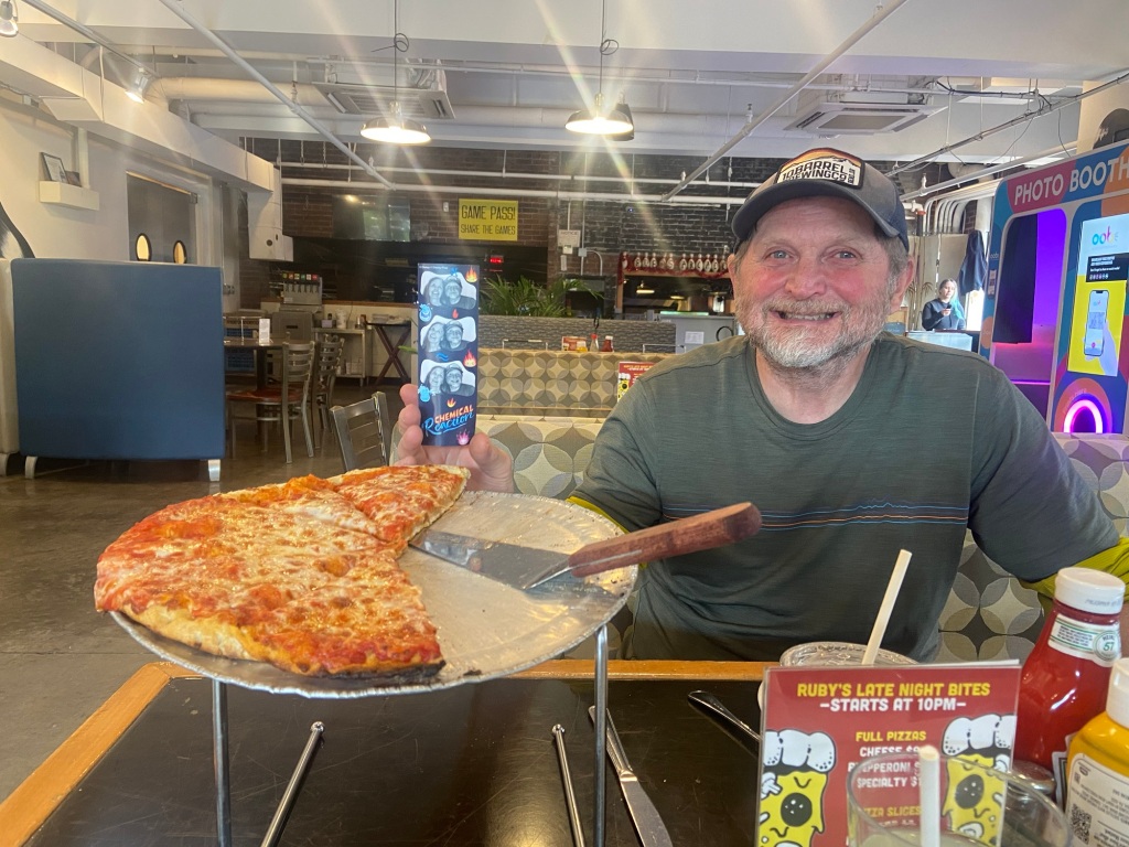
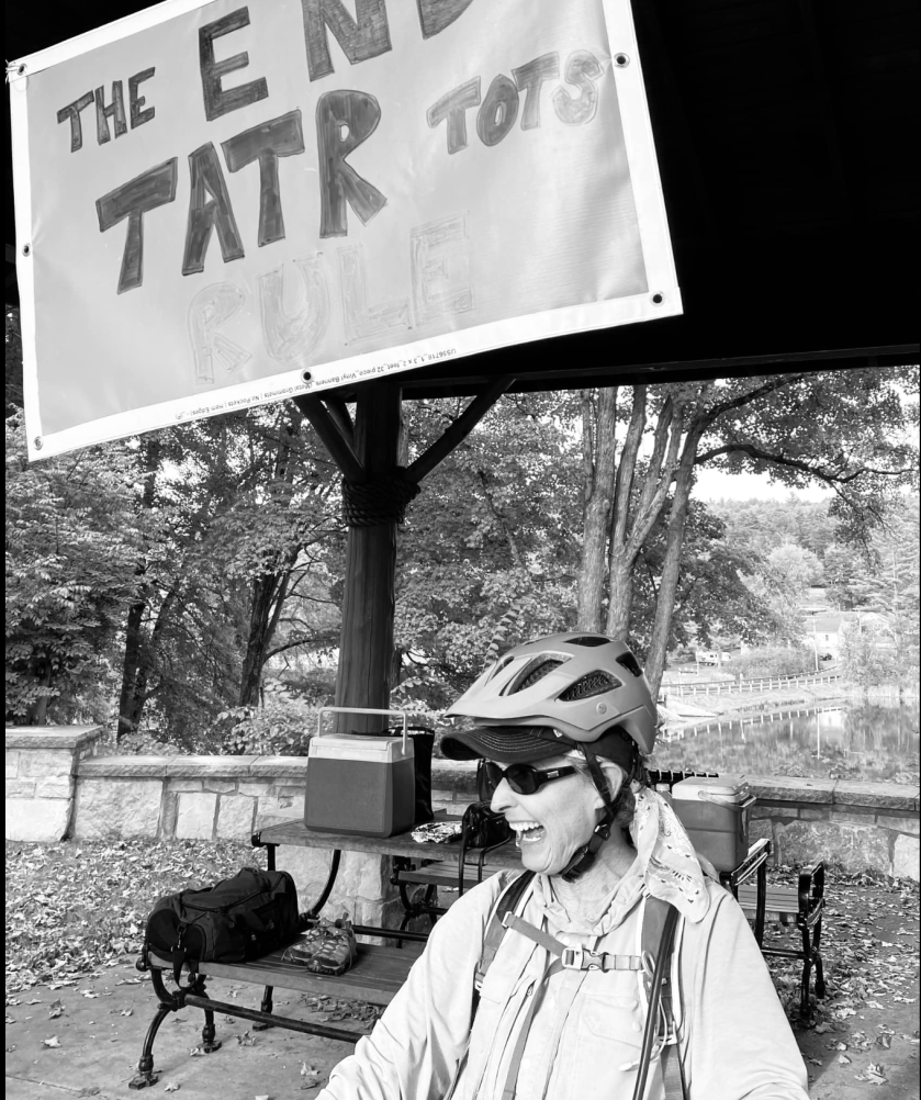
Pre-race meeting was at Ruby’s Arcade. What a trip – Duck Pin Bowling, ping pong, pool & foosball & pizza & a Photo Booth!
Whatever the race brings tomorrow, we are having a blast!
Saturday, April 20, Race Day
For those who like to follow the Trackleaders map, know that you’ll see everyone go “off-course” for a 12-13 mile section and possibly for a 4 mile section. We’re being re-routed for controlled burns but the detours won’t show on the map you see.
Also, there are 3 simultaneous races on The RockStar map: Trail, Gravel & Pavement.
To more easily find us, select the Riders tab on the main map, then choose “trail” in the drop-down option after the tabs near the top left.
There’s 81 racers on the 3 race courses combined. On the Trail course, there’s 22 racers at this point.
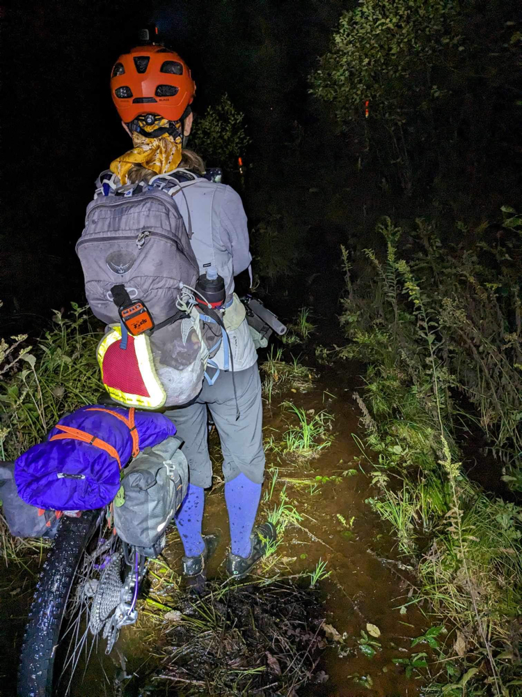
After tonight, I’ll go pretty dark even if I get to WiFi coverage since I’ll need to conserve my electronics for maps and other necessities. I’ll try to post at the start line and perhaps a time or two along the race!
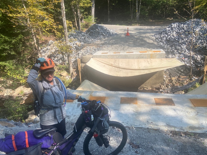
Without jumping over the rugged sections in western Pennsylvania threatened by flooding, we risk turning up in Harrisonburg days after the RockStar Grande Depart. Since there’s only two access points to rental car companies along our route, our compromise is to skip a few hundred miles on The Trillium section. That means we drive from Fairport, New York to Cumberland, Maryland.
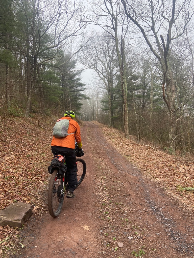
Week 1 was Training in Inclement Weather but this is a beautiful morning with just a little splattering of rain.
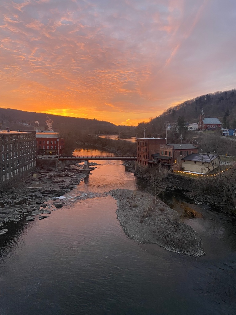
We start pedaling again from Cumberland. Lovely bike paths are immediately accessible— The Great Allegheny Passage and the C&O Towpath get us around the city and into The Hellbender.
We cross the bridge over the North Branch of the Potomac River into Wiley Ford, West Virginia — and Hill Training Week begins!
Right out of the gate I miss my picture of the day – a storefront window along the road in Wiley Ford, all by itself, in the middle of nowhere, in between big hills.
A storefront window filled with wedding dresses and pastel formal bridesmaid dresses. That picture in my head is for Karin Muewisson, soon-to-be daughter-in-law! I know Karin is all set, but a backup plan can sometimes be helpful!
A small store is next where we stop to resupply, and the owner makes us a couple of breakfast sandwiches on an electric griddle. Little do we know this will be our last real store until Virginia.
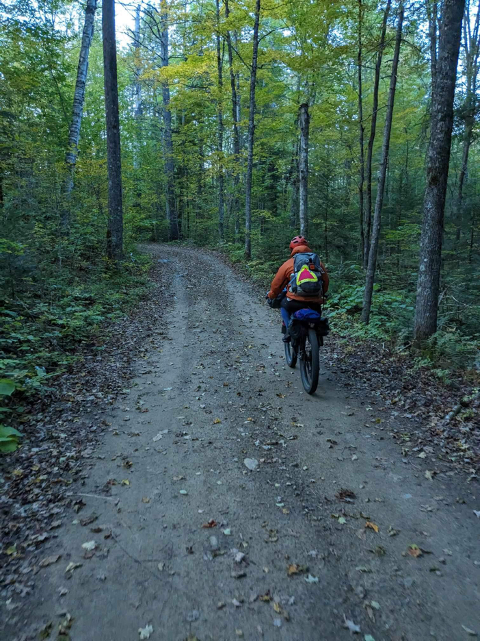
On to more hills.
All we notice of the eclipse is a bit of a chill in the air and a slight overcast. We fill bottles from a spring and go on climbing.
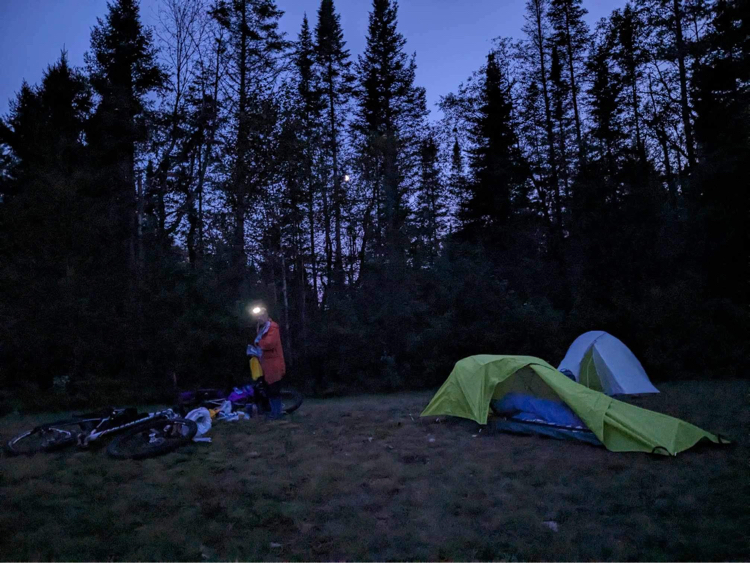
We find a covered pavilion at the Falls Assembly of God Church at 44 miles and call it a day. Richie Wizel, hiker on the American Discovery Trail from coast to coast, is already camped amidst the picnic tables. Richie hikes with a 3-wheeled cart and umbrella. His composite-tipped work boots are high to protect against snakes and are responsible for his trail name, Das Boot.
Das Boot carries an impressive charging system
I use the first of my freeze dried meals and Mike rehydrates his refried beans and pulls out his tortillas – emergency food we’ve carried from home.
As we finish up, the pastor and his grandson stop by to see if we need anything. Not only do we refill water for the next day, but they offer chips and sodas from the church pantry!
The pastor has recently retired at 82 and his grandson fills in for now
Tuesday
Hill climbing intensifies right out of camp.
Our kayaking days in the past took us to many rivers and creeks around the state, but this is a new corner of West Virginia for us.
It’s this day that we start “level climbing.” We face 5-mile+ climbs with 13-15% grades. I’m shocked to be riding them but I do need “stand over the bike” mini-breaks. I pedal up to a slight plateau, stop and stand for a few moments, and then manage to start up pedaling again.
The first little store is closed so we break here instead Smoke Hole Road seems to go on forever
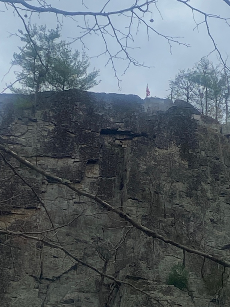
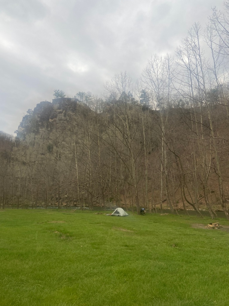
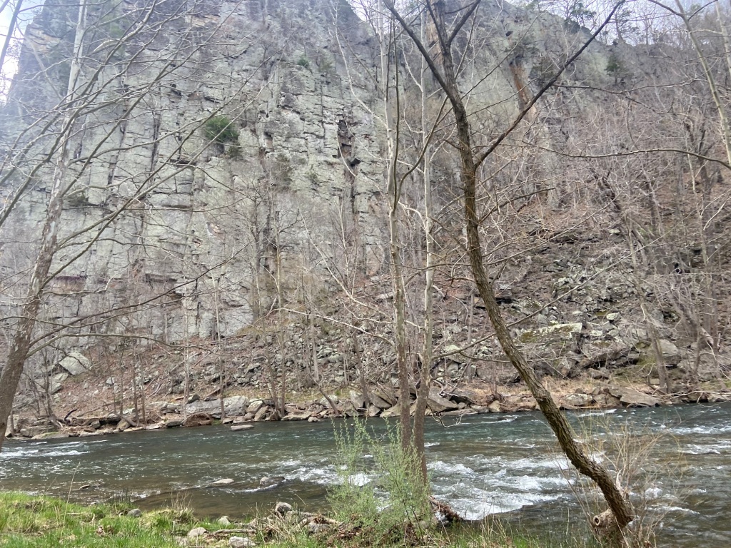
We camp at Eagle Rock on the bank of the South Branch of the Potomac River and dig into another package of emergency rations.
South Branch of the Potomac
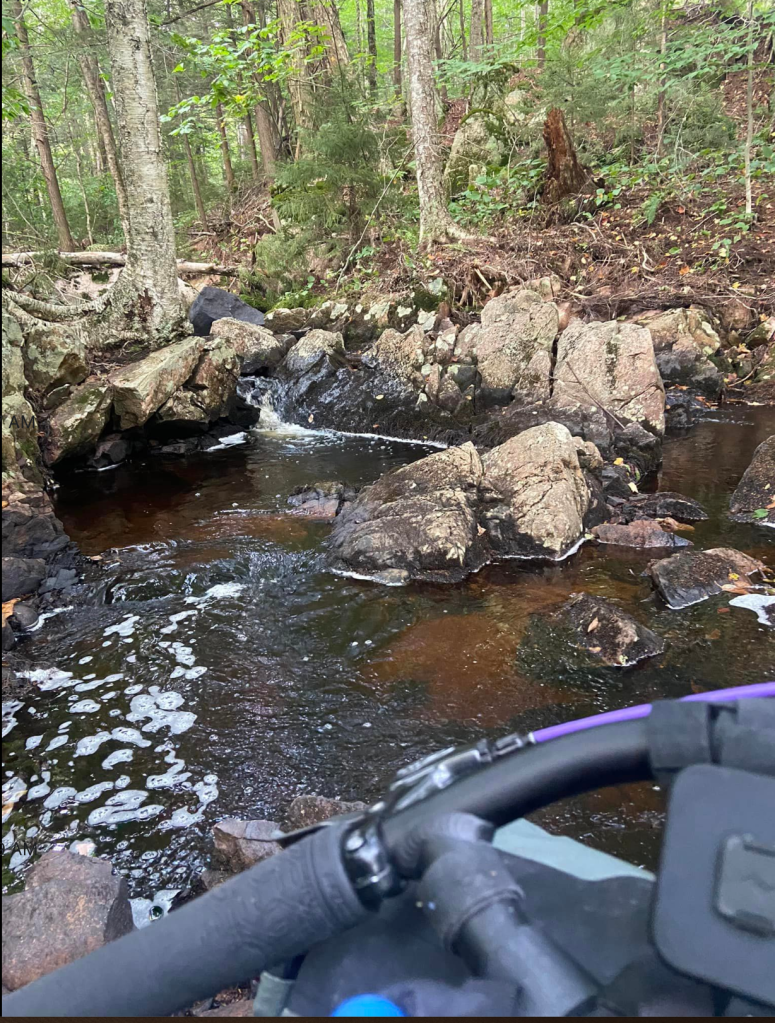
The river is a little on the high side and we hope this isn’t the one where we need to do a stream crossing.
Wednesday
We have a few snacks and start riding, hopes for breakfast pinned on Kyle’s Store. Ten miles later our hopes are dashed. We pull into a 1950-era gas station/store with a couple of old-timers sitting out front in chairs.
Kyle shows us where he keeps a few cans of diet sodas and we scan the nearly empty boxes of candy on the rack. A bag over the meat slicer cuts Mike’s hope for a deli sandwich. I walk around the dusty aisles, scattered with more hardware items than food, peering into empty coolers, until I spot an empty coffee maker on the counter. Kyle graciously agrees to make me a cup!
I find a couple of protein bars while Mike chats with Kyle about Joe Manchin. Turns out Kyle has known him all his life and says he’s always struggled—with both sides of the fence.
I find a can of corn on the shelf and eat that. We drink more coffee, fill our water bottles and take off.
Rain jackets and pants continue to be ready at any moment. It’s another day of “put the rain gear on, take it off, put it back on,” pedal mere feet and then remember to put the zip lock bag back on the phone….and stop again. Another stop to take it all off again. Repeat the cycle (pun intended)!
Oh, the hills….Mike is faster at “level climbing,” but the technique keeps me moving upward.
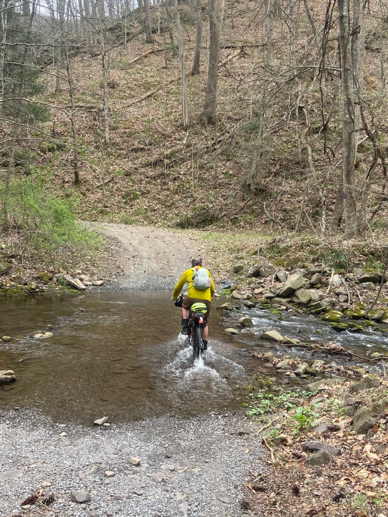
We turn off pavement and start riding Rough Run Road. Our feet get wet but that’s refreshing. By the 4th stream crossing though my feet are refreshed enough!
We stop to filter water and start our cold rehydration—another emergency ration.
I don’t think the climbing can get more intense but it does. I walk up a really long stretch. My pace has slowed and Mike comes back to push my bike for awhile. A Dominion Energy worker stops to tell us the best camping spot, for which I’m definitely ready. I wonder how he got his truck through the two deep stream crossings.
We eat and then I use my last emergency meal to cold rehydrate for tomorrow’s breakfast. We have little water left but hope to find more to filter in the morning.
Thursday
The morning starts with downhill for which I am grateful. The need for “on & off & on again” with the rain gear is even more frequent than yesterday. But we’re going downhill for long stretches!
Lots of fogMike aims for the next water bar for a tiny plateau up there!
We ride Long Run Road for a long time but eventually drop down and out onto a secondary road in Virginia. I spot a tap on the side of a church and for the first time today I feel I can freely drink the water I have.
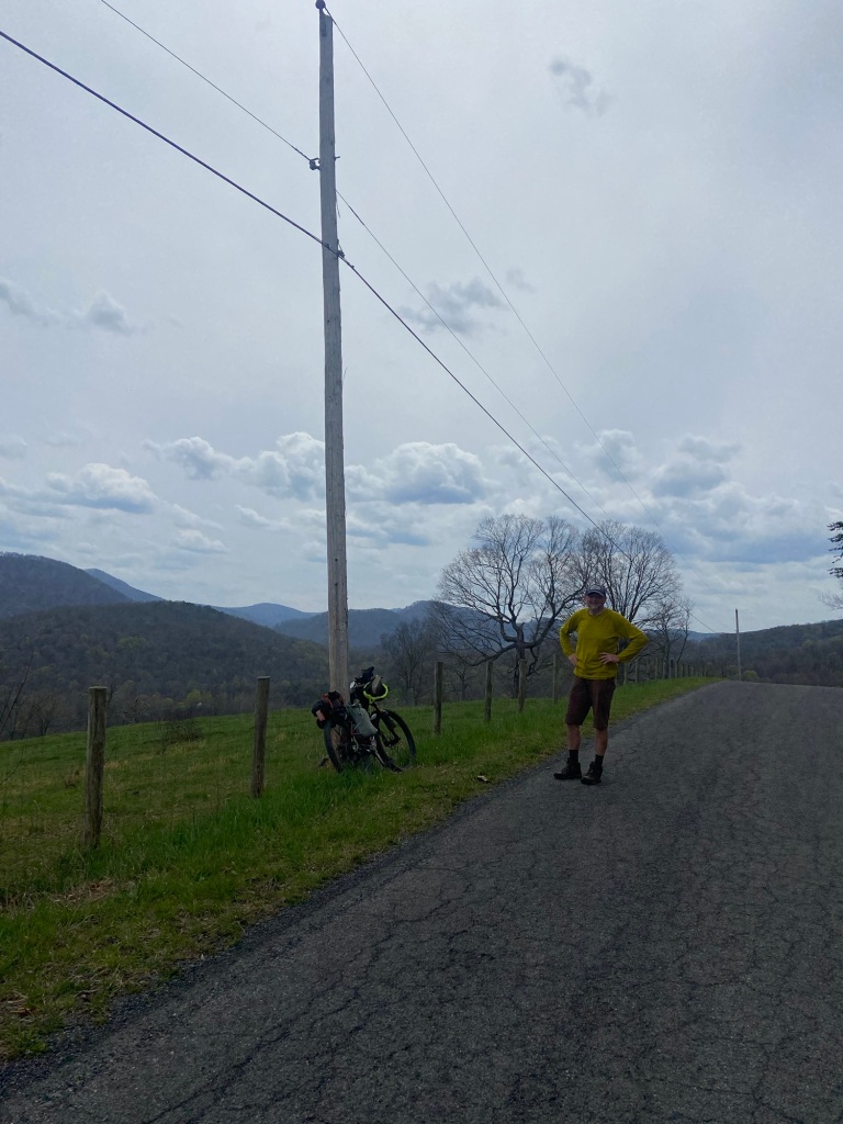
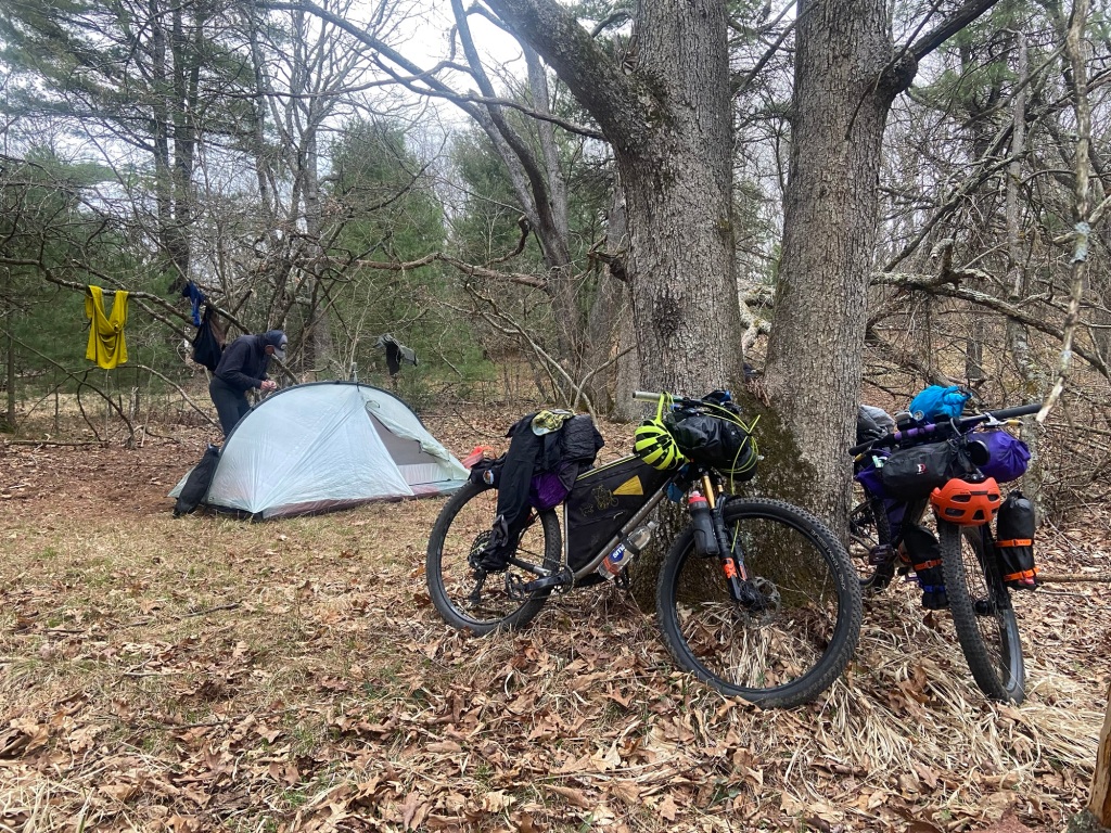
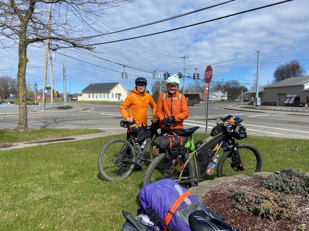
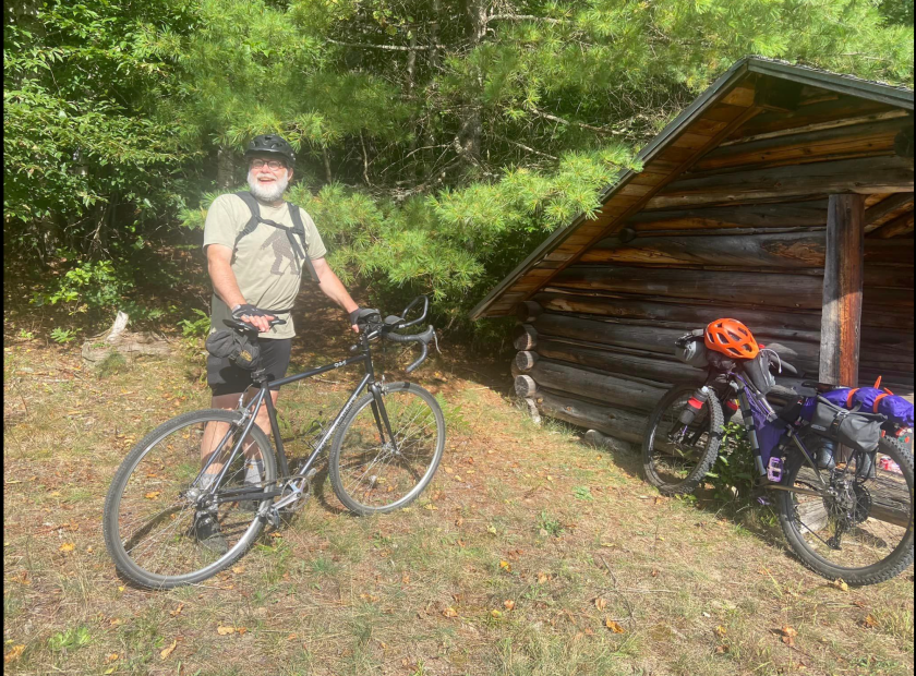
Uphill climbs are back to our manageable 10-15% grades and we roll into Harrisonburg around mid-day. We warm up in the Shenandoah Bike Company where we’ve shipped a box of resupplies they’ve kindly held for us.
I arrive with a handful of gorp and 2 goo gel packs. I always pack excess amounts of food but I went through it all on this stretch.
We refuel with an awesome meal at Pulp, the cafe in the bike shop, and then find a discounted motel for the night.
We’re more than a week early for the race, but better than a day late!
Friday
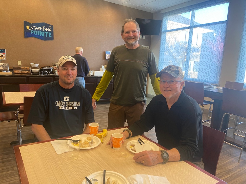
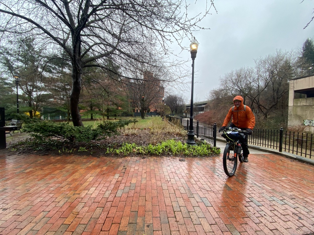
We upgrade to a hotel across the street and catch up on showers and laundry and food.
We meet a couple of Appalachian Trail hikers, father and son, at our hotel. Dad is 82 and a former, long-time endurance runner. They’re frustrated with being sidelined by the weather for days now.
Ghost (Marcus) from Florida on the left; Uncle Mike from South Carolina who got his trail name by hiking an earlier stretch with his nephew.
Saturday
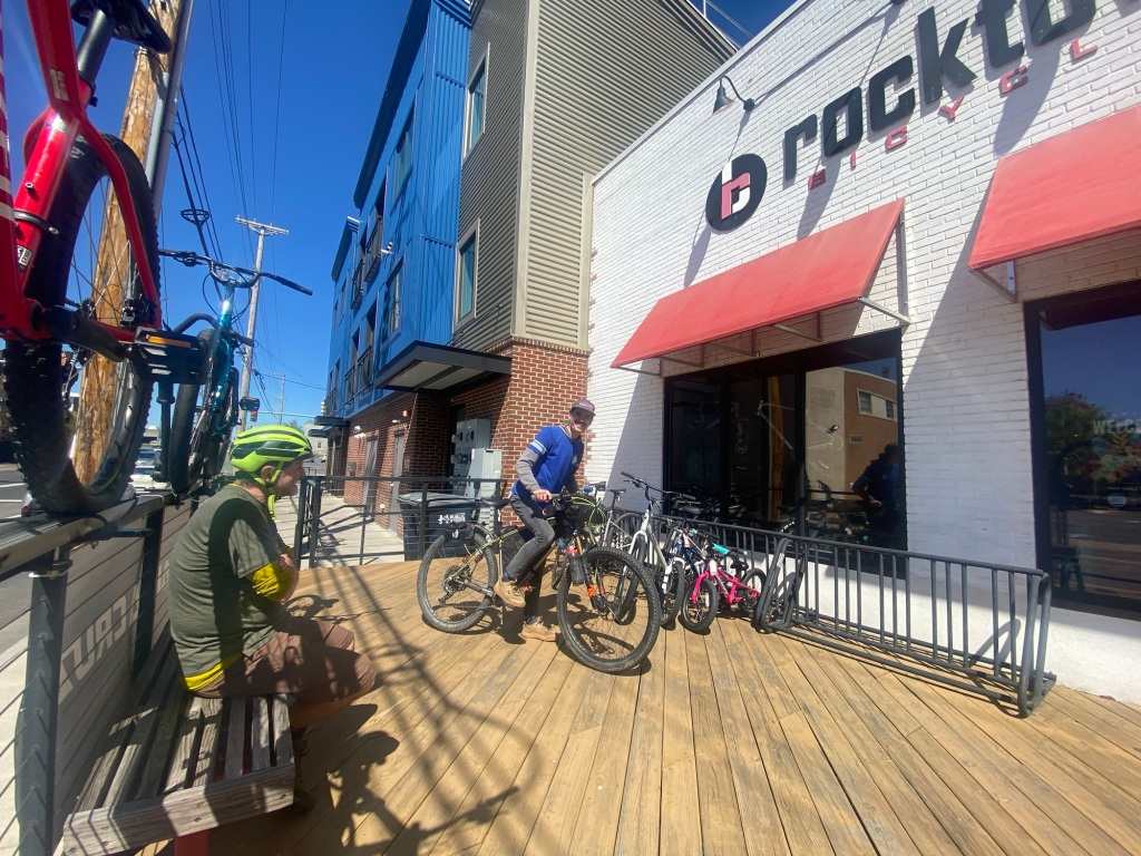
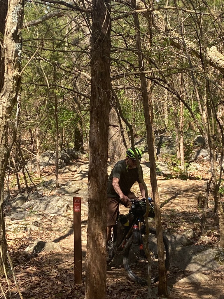
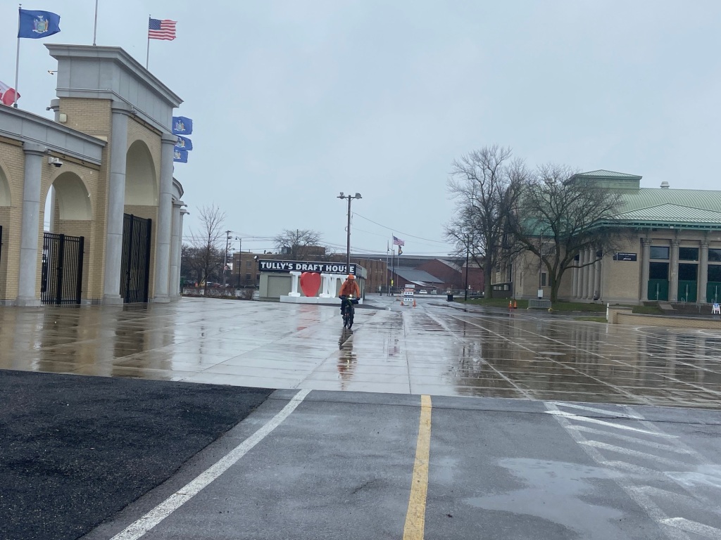
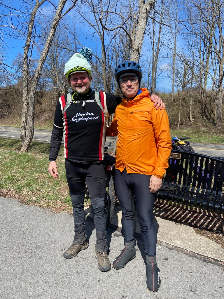
We explore the area, do some bike shop shopping and get to know the lay of the land.
Mike shares his bike with some local admiring bike mechanics.
Ben at Shenandoah Adam at Rocktown
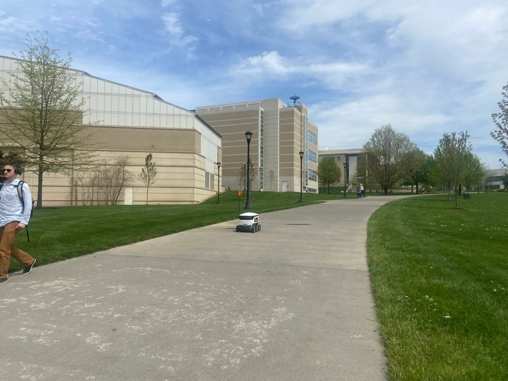
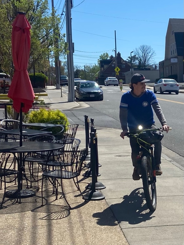
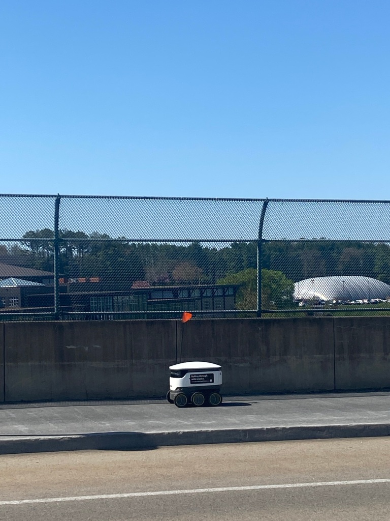
As we ride home through JMU (James Madison University), I nearly take out a starship on a downhill. No cars, no pedestrians, I think the intersection is clear. I only see the squat robot at the last moment because it flashes a green light and backs up onto the sidewalk.
Once I spot my second starship, I see it’s a robotic “box” to deliver hot and cold food to the dorms!
It takes my 3rd starship sighting and 2 days before I get the picture!
Sunday
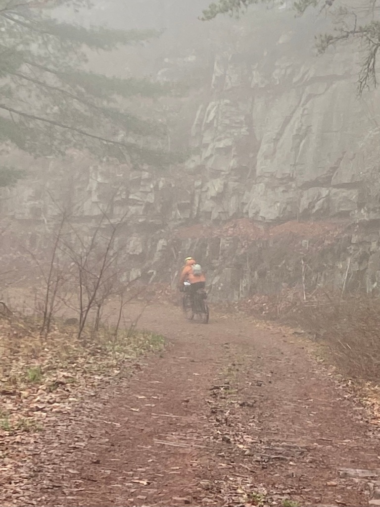
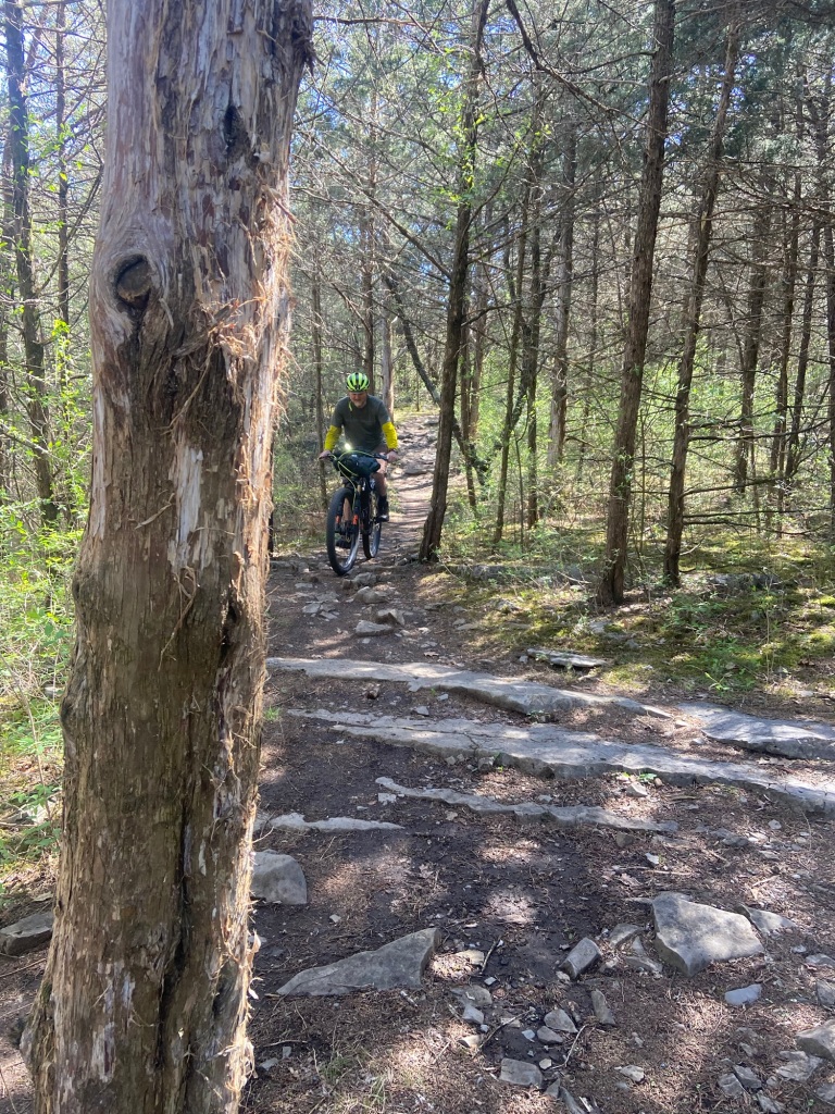
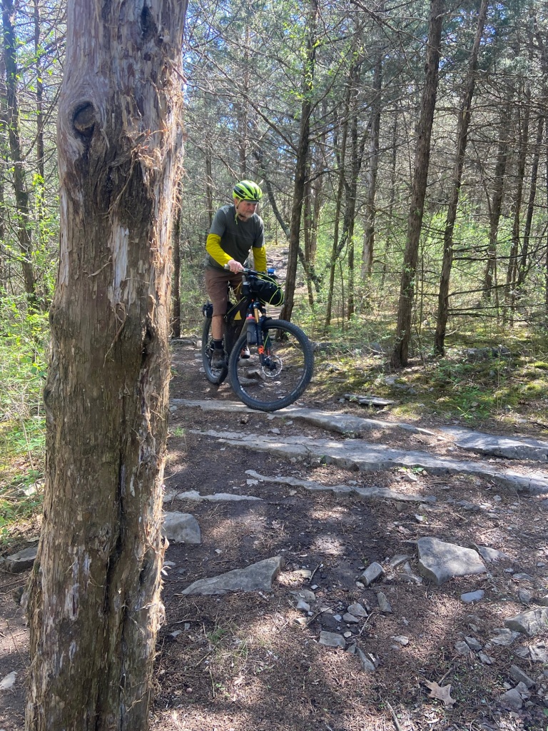
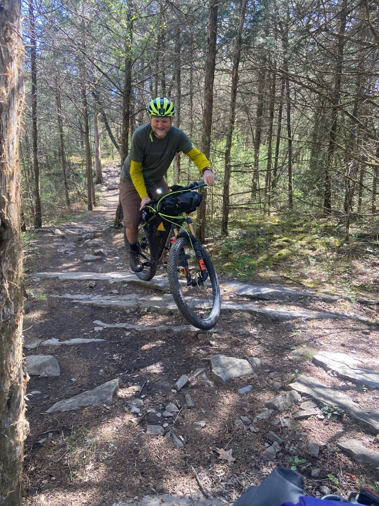
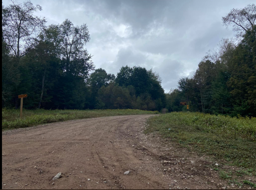
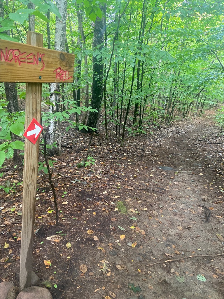
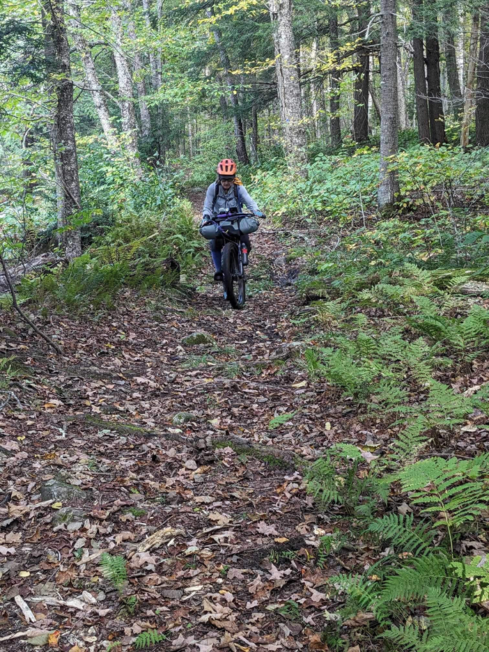
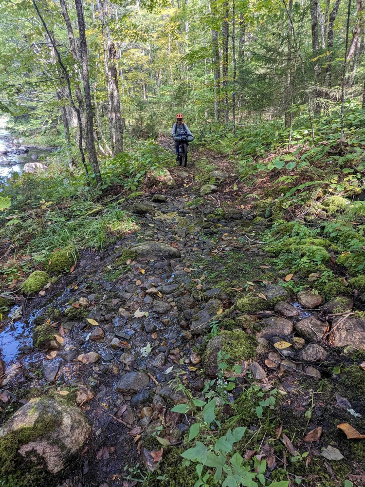
We ride the first 5 miles of the race and struggle a bit to get the turns down in the trail network in Hillandale Park.
I have a great video of Mike riding a more technical stretch but I can’t seem to insert videos here!
I have my walking strategy down (it’s in the video) but I still need to go back and practice the path through the trail network so I know the turns.
We’ll spend the next few days eating, recovering and organizing for the upcoming RockStar.
I’ll post again shortly before race day, April 20!
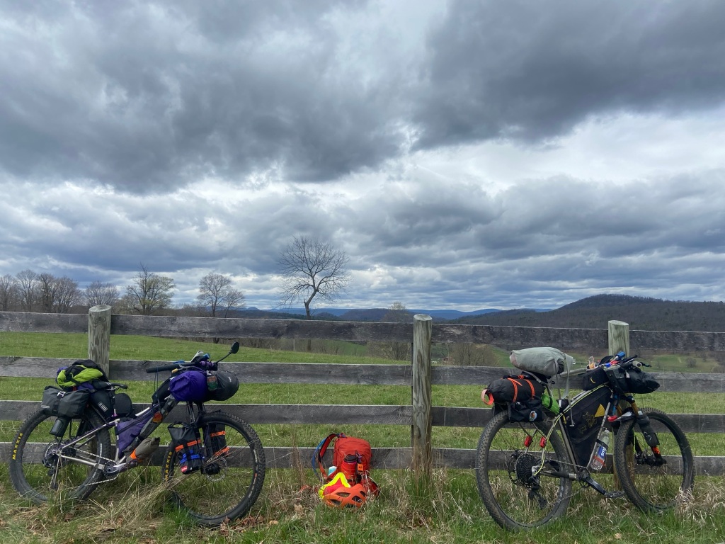
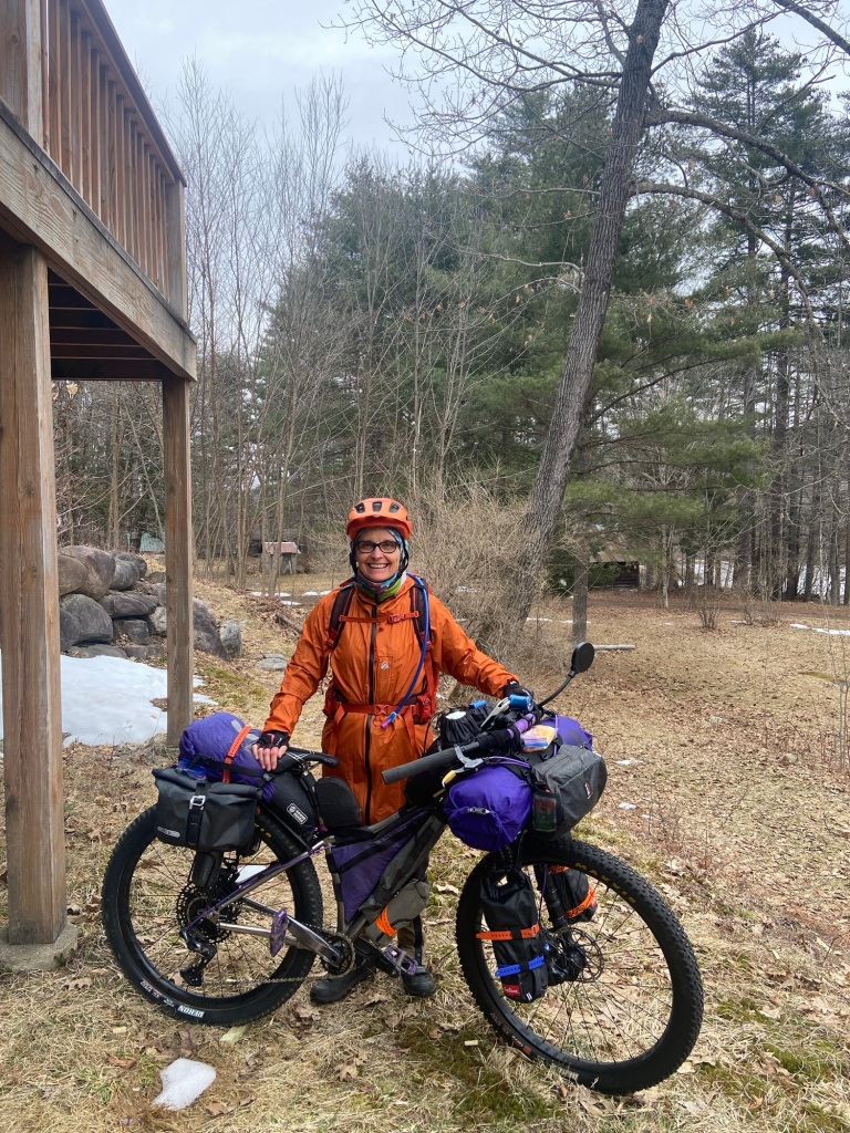
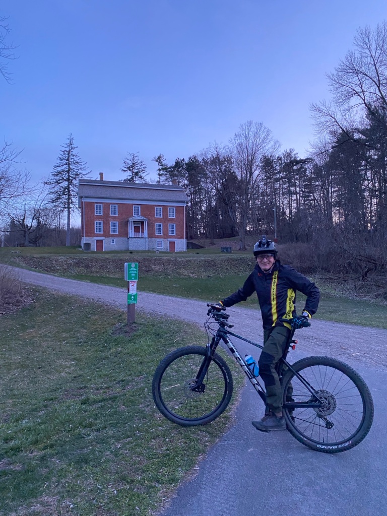
We leave home (Benson, NY) on fully loaded bikes, not sure if the adventure will be 2 months long or a little more.
Some time after Fort Plain we meet Skip who gives us the $2 historical tour as we ride along the Erie Canal bike path to Little Falls.
Skip
The weather was decent and we hoped to get out ahead of the impending snow storm.
My plan was to take one memorable picture each day. I missed two opportunities on Monday: the brightly feathered peacock sitting guard over a junkyard from the top of a chain link fence and one at dusk of Mike and Skip pedaling through the tunnel, reflective strips on their gear flashing in the twilight.
Tuesday
I get right to my picture of the day as we leave Little Falls in the early morning.
Another tough day for me. Right out of the gate with little riding in so far this year, I realize I’m basically leg pressing 2/3 of my body weight as I pedal up hills.
My plan had been to ride several days of 50 miles each to start, but the forecast had gone south and camping was off the table. To make it to motels we had to start with two 62-mile days and that is a push for me.
My mistake is putting lightweight polypro bottoms over my chamois shorts to stay dry. Bad move that causes a painful saddle sore. Every mile on the cinder dust bike path is excruciating. And the rain…fortunately our gear keeps us dry and warm…..and the snow will start soon.
Trail Angel of the day: the young woman in the convenience market in Canastota who offers to take our bag of goodies to the hotel for me- that paper bag would’ve been a nightmare in the rain on my bike!
Another missed picture: the Trail Angel!
Wednesday – Layover Day
Two nights at the Days Inn in Canastota. We need to time our departure to avoid the 5-8” of snow predicted. Turns out the 45 mph wind gusts are reason enough for a layover day…..along with everyone along the street telling us to get to the hotel and stay put.
We plot and strategize and think about modifying our original plan.
THE ORIGINAL PLAN was to bike the Erie Canal Trail, pick up the Trillium section and then the Hellbender section of The Eastern Divide Trail, and then drop off that as we approach Virginia. From there we’d pedal back roads to arrive in Harrisonburg to ride The RockStar Trail Race on April 20. I’ve registered to race; Mike may race it, or he may ride it instead of registering….to be determined!
The plan is to be ready for the 270- mile RockStar after riding 850 miles of the Eastern Divide Trail. My slow start and the weather is forcing us to consider other options.
Missed picture of the day: downed power lines whipping around the roadside as we venture across the street for food!
Thursday
Finally, a 50-mile day will put us in a hotel, this one in Weedsport. We depart Canastota at 8 am, after the hard rain but before the snow. Our timing helps but rain, snow and sleet find us anyway. The Canal trail winds through downtown Syracuse, along the river-walk which is under water in places as the creek rushes over the bank, through the gate of the State Fairgrounds and across a long causeway around the edge of the lake.
Highlights of the day: warm knee warmers for me when we stop at a bike shop and a fried chicken dinner at Cook’s Diner.
Video of the day :
Along the river-walk, downtown Syracuse
A few more pics around Syracuse:
Cute little parks along the Canal Trail – seems to be more of them as you travel westThe State Fairgrounds View from the causeway
Friday
Now we have a revised plan. Weedsport to Geneva today, then to Fairport on Saturday.
Off to Geneva we ride where we have a wonderful visit with a fellow TATR rider and his family. We talk all things bikepacking and ponder why some riders are so drawn to these types of rides.
Good weather- more pictures!
Trail approaching Geneva
Almost to Geneva!
Saturday
Sarah & ZiggyOur new friends in Geneva!
In the morning, Mike E. rides out with us, heading north to get back to the Canal Trail. No snow, no rain, just gusty headwinds.
Mike E & Mike The things Mike finds on the trails! He already gave away the pink sunglasses!
From there we continue to Fairport for a phenomenal visit with our son, Matt, and soon-to-be daughter-in-law, Karin.
Mike & MattOut on the town in Fairport
Sunday
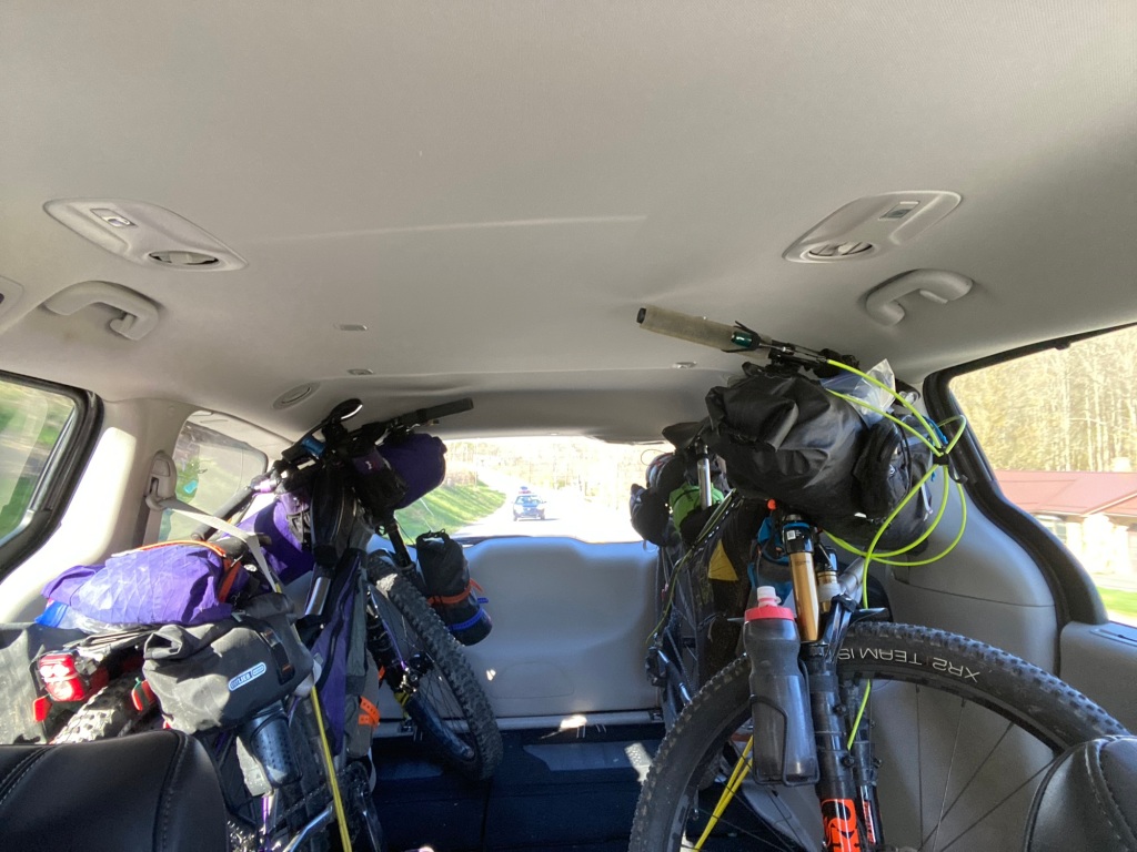
The revised plan is to rent a minivan so we can hop, skip and jump over the rest of the Trillium section. Flooding could wreak havoc over the rugged sections in western Pennsylvania and we don’t have time to spare.
So we drive the bikes to Cumberland, Maryland and in the morning we’ll start riding The Hellbender section.
Everything fits!
We’ll be on remote trails for some days so I’ll post an update once amenities permit.
NOTE: This particular blog is not just a write-up on bikepacking TATR, but it is just as much about my health journey as I put the pieces together to understand it all.
The Adirondack Trail Ride, TATR, also known as a race, despite the best efforts of “race” director Mikey Intrabartola to present it as a “ride,” has been a focus every year for me since 2016. I finally learned this year to stop racing against my previous times and instead focus on “quality miles.”
Racing against others is simply not in my cards since as I often say, “I’m just not built for speed.” That said, I do love passing someone who is sleeping late at night on the side of the trail. Of course, that racer promptly passes me back the very next day, never to be in my sights again!
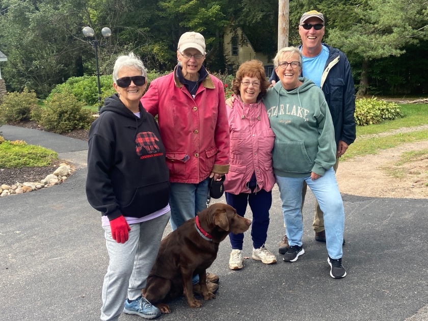
Saying our goodbyes to Marnie & Mikey.
This is race #3 of the St. Lawrence Triple Crown for Mike!
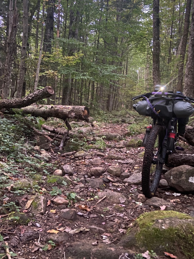
All 588 miles of the course are tough, even the sections of pavement since you’re often recovering from riding tortuous obstacles on the “trails” (snowmobile trails that see little traffic and even less maintenance outside of winter; rooted, slippery, rutted hiking trails; trails engulfed with mud holes that sink both you and your bike far too deep; boulder gardens to either ride or “dance” through with your bike: and downed logs that take a 4-6 step maneuver for me to haul my 60-65 pound bike over).
Or, you’re climbing 3,000’+ on those rather short paved sections. Same goes for the dirt road and gravel sections. My Garmin clocked in at 44,403 feet of climbing this year. (That is just shy of climbing both Mt Kilimanjaro and Mt. Everest!) The race director isn’t sure how Trackleaders determines its 26,600 feet of ascent, but it is definitely far off the mark.
No matter how many days you use to complete the course, sizable obstacles cost you time, energy and everything you’ve got each day.
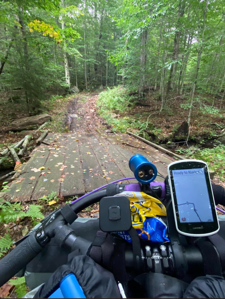
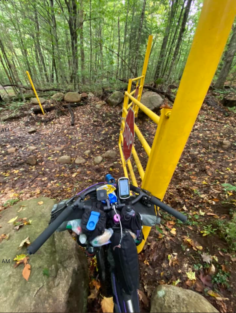
Navigation presents its own issues. Cell service, internet and general ability to contact the outside world is quite limited, spotty at best, when you’re deep in the remotest pockets of the Adirondacks. Garmin, Wahoo and other electronic mapping devices all have their own issues and will leave you exasperated, crazed and sometimes scared as they can lead you off-course or completely drop the loaded course. Still, keep your eyes open for that makeshift sign along the trail that says “cell service here.” And by “here” it means stand “here” and make your call!
Signage upgrade!
Anyone attempting the race should have a back-up to their preferred device. I’ve used Ride with GPS as a back-up but that exhausts phone battery in my opinion. I find the Gaia App to be most reliable. I find it easily locates my spot on the course so I can quickly double check my Garmin “off-course” alerts. I know the whole course so well that I rarely need to check either device so I leave my Garmin on battery save to record my ride and simply pull up the Gaia to double check the tricky sections. To get the entire course on 1 GPX file, waypoints have been dropped, making the course a little “off” in places. Situational awareness is paramount.
The other critical planning issue is food and water. There is some kind of a resupply point, at least convenience store food, about every 70 miles or so. It can be trouble to assume you will automatically make the 70 miles or so to resupply each day, especially since store hours are often reduced after Labor Day in the little Adirondack villages. If, as on day 1, there is an extended stretch in the woods and a sizeable amount of climbing, you need to carry a water filter. Should you have a mechanical issue with your bike, you need not only the tools for repair but a water filter in case you don’t get to the resupply point.
You may be the biker who can easily make Speculator (mile 72) the first day, but be prepared in the event you need to camp for whatever reason. It can get really cold at night and there can even be vicious mosquitoes in September, a first this year in my 7 years on TATR.
So back to my “quality miles.” The last thing my Physical Therapist (PT) said to me before the race was, “don’t think about mileage, the quantity doesn’t matter. Do quality miles.”
Day 1
I don’t know what he was talking about but it hangs in the back of my mind. “Quality miles.” Night #1, I camp at mile 40.2, at the Murphy Lake Lean-to, my worst 1st day showing ever.
My legs have been threatening to cramp since I entered the 20-mile section of woods off Creek Road. I spring off my bike like lightening each time I feel the spot along my right thigh trigger, which starts a historical, horrible pattern of ricochet cramps up and down that leg and up into my right abdomen. Every year prior, that debilitating cramp pattern has stopped me in my tracks and hobbled my progress for about 3 days going forward.
This year I mostly walk the 4-mile uphill stretch to Murphy Lake and commit to my early camp spot in my mind, argue with myself, re-commit to the plan, and then ultimately stop to camp without the leg and abdomen going into full-blown cramping. Still, for 4 hours I “nurse” my leg to prevent the cramps from going off. At 10 pm they ease, but then a deep aching in my left acetabulum starts. (It took me a while to learn that word, but it’s the hip socket that we’ve been working to stabilize.)
This is new- and so painful. Never before have I considered quitting on Day 1. I think about my PT’s advice to forget about mileage. I remember the advice I always give to others – “don’t quit when you’re exhausted, hungry, hurting or injured….sleep on it, ride some the next day and then consider your situation before calling the race.”
Day 2
The aching keeps at it until midnight but I sleep from then until 3 am. Since I can’t get back to sleep, I get back at it. I walk the first mile+ in the dark (always have an excellent light on the handlebars as well as one on you that lights wherever you turn your head).
Murphy Lake Outlet
Once I’m on a slight decent I coast on the bike and begin experimenting with pedal pressure on that right leg. Pressure is no longer triggering the leg – yahoo! Still, I am kind to it, coasting when possible, walking up anything that is at all strenuous.
The “Turnpike”
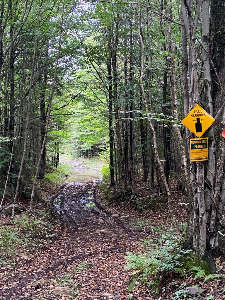
After crossing Pumpkin Hollow Road, I re-enter the woods for the next 12 miles (to complete that 20-mile section). The trail is solid until a mile or so beyond Pine Orchard. After that though, the trail has become less rideable in the 7 years I’ve been a regular on it. Despite bemoaning the high public usage of the High Peaks Area and how the public needs to start utilizing the low-trafficked Adirondack trails, the State Department of Environmental Conservation (DEC) does absolutely nothing to maintain this trail, as rocks, roots, and other hazards alter the foot bed.
A few TATR volunteers (Mike Feldman & Dan Remington) routinely clear trees off this section, which makes the hike-a-biking easier, but they can’t address the foot-bed of the trail. DEC, if you’re listening, if you really want to offer alternatives to the High Peaks hiking, there’s ample opportunity to improve and maintain trails in the southern Adirondacks.
I am grateful for the Jimmy Creek bridge repair following the recent washout (thank you Mike & Dan) that included firring strips up the steep ascent. First time I make it without using yak-track boot spikes – which I will now carry for another 530+ miles. But that’s okay. I have them if I need them.
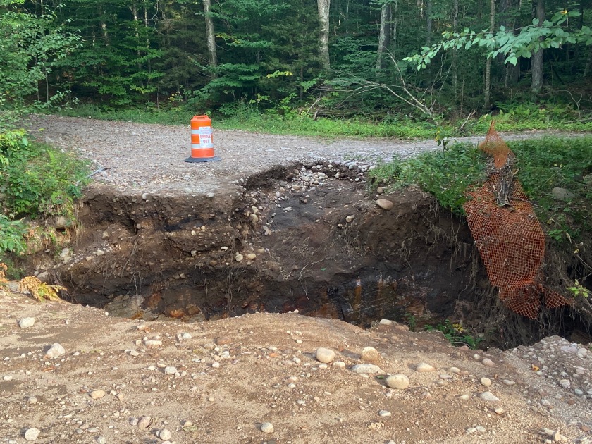
Stay right – support on the left has been washed away.
Once out to the pavement on Rt 8, mile 55, I’m good to go for another 7 miles or so to a point where I consider pedaling off-course to Speculator for a motel, knowing I would have to back-track the additional 4 miles in the morning. Fortunately, I’m thinking clearly enough to know I need to just tough it out to Speculator, so I do. My first food frenzy is in Speculator, where I also realize that 2 rounds of Tylenol a day is helping to mitigate the left hip pain.
Finally tucked into the Cedarhurst Motor Lodge, I realize I left my spiky foot massage ball in the grass by the picnic table when I first turned onto Elm Lake Road. Then I almost backtrack to the Mountain Market, thinking I left my 2 Snicker bars on the counter but they turn up in the refrigerator. I can’t find my spare insoles and decide I must have forgotten to pack them. The “muddled mind” has begun.
Day 3
I leave Speculator for the Fawn Lake mud disaster route, already deciding my PT was right. Mileage does not matter. I will stay in Indian Lake at a motel. Just before sliding into the cell-free zone for the day, my motel of choice notifies me they have no room due to the antique show. Right there, on the side of the road, a mile from the Fawn Lake Trail, I secure a room at a motel just south of Indian Lake. I’ve committed to my PT’s recommendation of “forget the mileage.”
Fawn Lake Trail
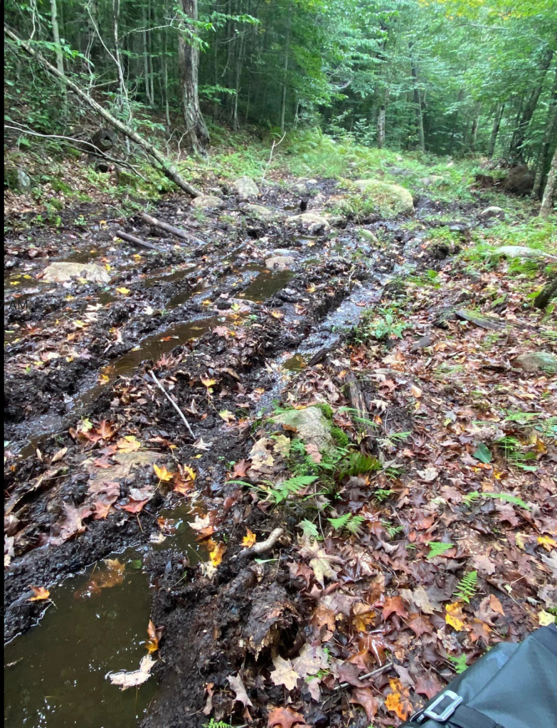
I take care to keep my feet dry as I negotiate 1 mud hole after another that spans the trail. I’m proud of my dry feet even through Willis Vly where I get my soles wet but prevent the water from going over the tops.
Willis Vly
After the T, and the right turn onto the Perkins Clearing Trail, the bridge crossings start. I count 16 bridges over this trail that is maintained in the winter for snowmobiles, just not for hikers or bikers in the other seasons. DEC, are you listening to the opportunities here?
The trail is wet and slippery, so I walk 14 of the bridges that are potentially slick as ice. A time sink but I’m feeling good. Once past the bridges and the crazy hill climbs, I negotiate the roots and rocks and feel my hips actually moving my body out over the bike like they should. This is new for me and huge. This will make a big difference on single track riding! My hip isn’t hurting and is actually moving differently. I suddenly understand the meaning of “quality miles”!
When I fall the first time I slip on a root but almost manage to stabilize myself. When I go down it’s in slow motion and I marvel at being able to manage my landing. When I crash the second time it’s faster but still effortless.
I falter after I zig-zagged right among the rocks when I should have started left. Body and bike are fine but the cell phone is caked in mud. Fortunately, I always have a cord in the charging port on my phone to protect against moisture or dust, but mud is caked into the seams between the phone and case and into the power opening. I worry I may lose “contact” but it doesn’t turn into a problem.
I walk long stretches of sketchy trail after that, sacrificing my feet to the continuous string of mud holes, until I reach the clearing where the trail ends and the gravel to the Jessup River Road begins. On to Mason Lake and Rt 30 where I work on “quality miles” on the pavement to The Point Breeze Motel, 14 miles north. Big hills on Rt 30, hills I’ve always walked in the past—but not this time. I’m learning to slow my cadence and reduce effort.
In the Canadian races earlier this season (the Butter Tart 700- BT700; and the Log Drivers’ Waltz -LDW) I worked on staying in the first few gears when descending to simply coast into the next hill. I’ve always spent way too much energy pedaling hard to get to the uphill to simply exhaust myself halfway up the climb. Nothing is intuitive for me.
My practicing in Canada pays off and I climb every hill with little energy, less effort. Not fast of course, but then I’m not….built for speed.
I find my spare insoles….packed, in a different spot! I also realize that last night I must have thrown out my long-handled spoon for my freeze dried meals.
Day 4
Food Frenzy #2 at Stewarts in Indian Lake. I discover that my magical riding shirt not only keeps me cool in the Canadian heat, it also keeps off the Adirondack chill AND it easily fits a breakfast sandwich in each front pocket. I eat the 3rd and I’m off toward the Moose River Plains.
For the first time in my mountain biking life, I pedal up every paved hill on the Cedar River Road. I have a few walks once the uphills turned to gravel, but I don’t want to push so hard that I’ll pay physically.
Shortly before reaching the Wakely Dam, the rain comes down heavy. On goes the rain gear and pack cover, and I race to the mini-overhang at the ranger cabin. I eat until the rain lessens and then start the now hot and humid ride toward Inlet.
Always thinking about quality miles now, I ride up hills that have always slowed me to a walk in the past. I do have 2 walks on the longest of hills but what a personal improvement. The rain continues, on and off….more on than off.
Moose River Plains
I realize the other thing in my favor was starting TATR with a toothache, likely caused by sinuses according to the dentist. That sounds odd I know, but to keep from chewing on the right, I cut protein bars into tiny pieces and keep 1 in my left cheek as a slow protein drip. I switch snacks around but pretty much keep the slow food drip going at all times. Even as the toothache eases over the next few days, I keep the habit going.
I stop at Roger’s Convenience Store just before Inlet’s “downtown” strip. The grill is off in anticipation of closing 2 hours later. I buy a can of ravioli and the clerk heats it in the microwave – early dinner.
Last year Inlet acquired a Frankenpine tree that provides cell coverage so I’m able to check Mike’s location on trackleaders.com. I’m impressed with the new cell coverage and Mike’s ride. He is approaching the Debar Mountain trail, more than 200 miles ahead of me! I resupply for the next 2 days and take off.
I pull into Daikers Brookside Motel, just past Eagle Bay, at dusk and Andrea has bike towels and a hose ready for me. My bike hasn’t seen a hose since Speculator so it is still sporting a good deal of muck from Fawn Lake.
I much prefer the bike-in-the-room friendly lodging over the more expensive motel in Inlet that is not quite so bike friendly. Andrea is an old friend now, having stayed at her motel for 3 or 4 years. It positions me farther along the course and is mere feet from the South Rondaxe trail.
I clean up the bike and call it a day.
Day 5
Although I love seeing Joe and Marion at the Stillwater Hotel, they’re on vacation for a few days and that would make a super short day anyway since I just left Eagle Bay. So on I go on my journey to the Oswegatchie Educational Center, where Bill, Todd and the others exceed all trail magic expectations!
My epiphany for the day is realizing that I’m unstable when coasting with my left leg forward – that’s the left hip socket issue. I expect I need to strengthen that to stop the aching. My right leg is more stable when forward but is “off” if I try to initiate peddling with that leg while standing up. That hip tries to kick out to the side when initiating; but if I initiate the standing pedal stroke with my left leg, the right then follows more smoothly.
I suddenly understand 2 things. I feel now how my PT has been working the hip socket on the left while also working to increase stability and strength in the right-side standing femur. I needed to feel these opposite issues to really understand them! I also understand my dysfunctional pattern climbing stairs that has plagued me for decades. Looking forward to my next PT session.
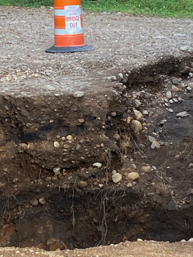
Once again, I’m reaping benefits of all my recovery work as I pedal up so much of Fish Creek Rd that I had always been forced to a slow walk on in the past. Fortunately, I see the gaping chasm in Roaring Brook before I get to the edge.
I see the cone on the far side of the gap that Mike posted on Facebook, however, I had thought this obstacle was beyond the Oswegatchie Center.
I find a faint path in the woods just upstream that takes me easily across since the Brook is not “Roaring” at this time.
I find the Oswegatchie has upped its Trail Magic game once more. They now put out towels, making that welcome hot shower even better. After a good chat with Bill, a good sleep, a solid breakfast and a quick visit with Robin, I’m off.
Day 6
I’ve planned an incredibly short day, with an Airbnb in Star Lake. I could certainly make it farther along, but that would mean ending with a grueling hike-a-bike (HAB) on the Moore Trail to camp in Wanakena, the prettiest little (and perhaps coldest) village in all the Adirondacks.
I’m finding that motel stays are key to continue my recovery and progress from abdominal surgery that I had last spring to remove a 50-year old adhesion that “glued” my small intestine in place when it should be freely moving. Since that surgery, which also necessitated a bowel re-section, my intestinal health has basically improved to perfection for which I am ever so grateful. I’m also working hard in PT to gain movement patterns that have been restricted for those 50 years.
As I used the June BT700 race to strengthen following the April surgery, and then the July Log Drivers’ Waltz to increase my stability on the bike, my historical right-side cramping pattern from leg into abdomen (or perhaps the reverse) persisted. Even though the adhesion is no longer there to interfere with muscle patterns, layers of deep fascia (connective tissue) still restrict my movement in many ways. It’s incredibly frustrating since I thought I’d be up to running speed once the surgery solved the big problem.
But I am finding that while TATR, with such strenuous biking every day, brings me to the edge of my movement restrictions, it also brings focus and awareness to watch and feel how the debilitating cramping pattern persists. It seems to all translate into the what and how of my PT program.
In a motel room it’s a whole lot easier to do another round of PT each time I wake up in the night. Much tougher when camping for me! It’s like being in an incredibly rigorous PT session everyday, all day long. Had I not done these races, I would have gone crazy when the pain pattern arose erratically after some rides but not others. Every race this year has given me great insight on how to not only protect my abdomen but continue healing it.
And so, on Day 6, I have a scenic and enjoyable ride through the woods to Star Lake, every bit of it so much easier than in past years.
Microburst Boulevard – the “boulevard” cracks me up on this turn! Is this THE only boulevard in the Adirondacks?
Somewhere near Mouldy Pond, which is somewhere near Bryant’s Bridge.
The “fun” stretch!
Love how “helpful” the Garmin is in the woods!
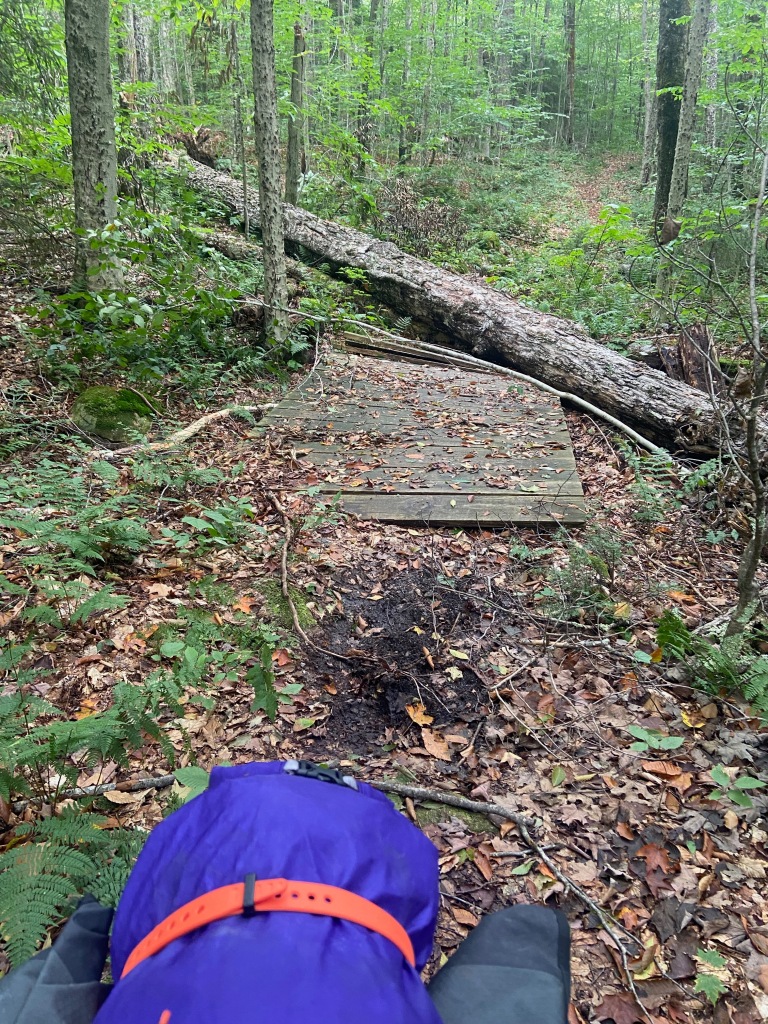
These types of obstacles are often the biggest time sinks when riding solo, self-supported.
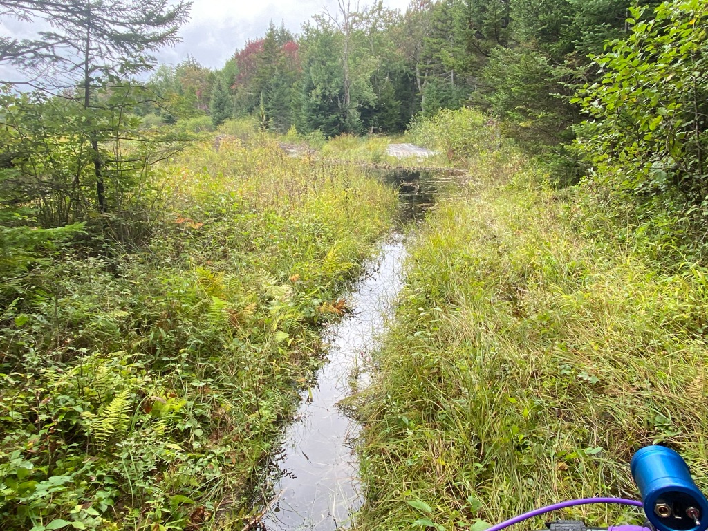
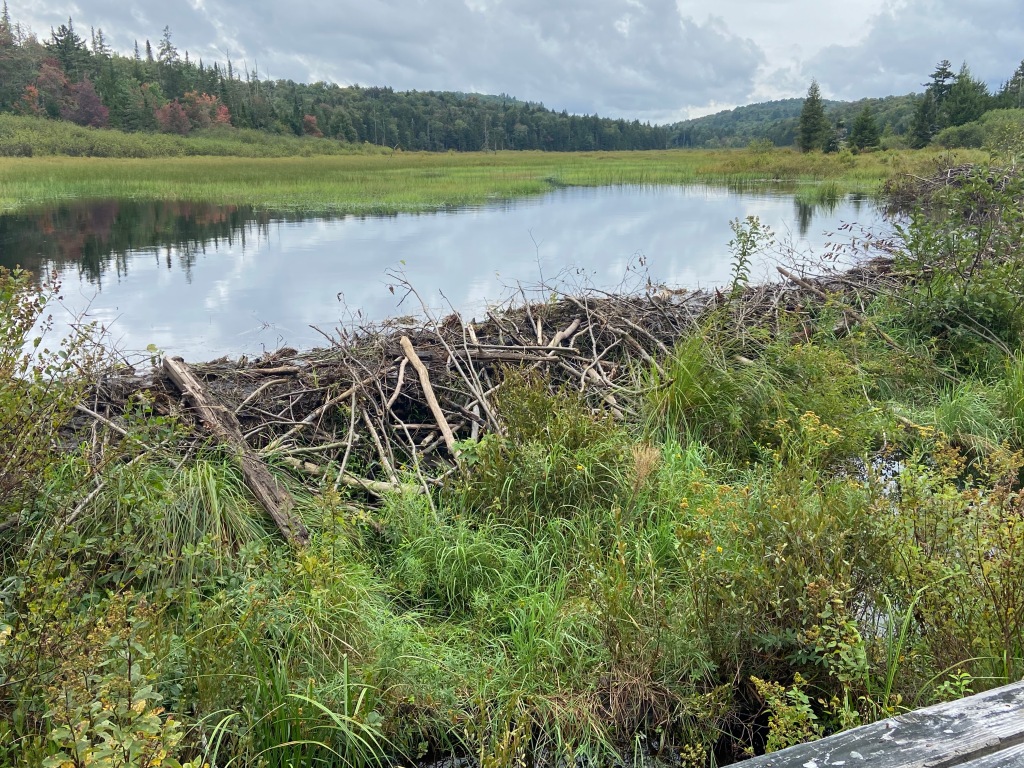
A new bridge over the beaver dam, so close to Star Lake.
My Airbnb host provides bike rags, a toothbrush to deep clean the drive chain, a hose at her house next door, and great company while I do bike maintenance.
Then I get on with Food Frenzy #3, with salad and stuffed shells and 12 half-moon cookies from the Circle K while my clothes go through the washing machine. Little do I know how important that clothes washing will be since it will be another 7 days to the finish for me.
Day 7
I depart for a super short day of about 18 miles. I have the rough and tough Moore Trail to start, followed by The Peavine Swamp Trail and the Cranberry 50. None of it easy. If I don’t take the Coyote Den motel in Cranberry Lake at mile 244, I’ll be camping and utterly exhausted when I do camp.
My saddest moment on TATR occurs just a half mile after leaving my Airbnb. I meet a group of 6 when I stop to pet Willow, a beautiful chocolate lab who reminds me of our Creeker girl so many years ago.
We chat and share a few stories and they invite me to join them for a cup of coffee. I decline since I’m starting off 2 hours later than I had wanted and I desperately need an early finish to the day. I never refuse a cup of coffee and I always make time to chat with people I meet along the way, but I just can’t with the difficult ride in front of me. So we say goodbye and I’m off again.
Near the start of the Moore Trail.
The Moore Trail, like the section following Pine Orchard to Rt 8 and the sections through Fawn Lake and Perkins Clearing Trails, is simply not sustainable. Eroded sections on the Moore Trail could send the unsuspecting biker into the river. Rock and log strewn sections slow one’s HAB pace to a slow crawl. The Peavine Swamp trail saw little maintenance this year although it starts at the Ranger School.
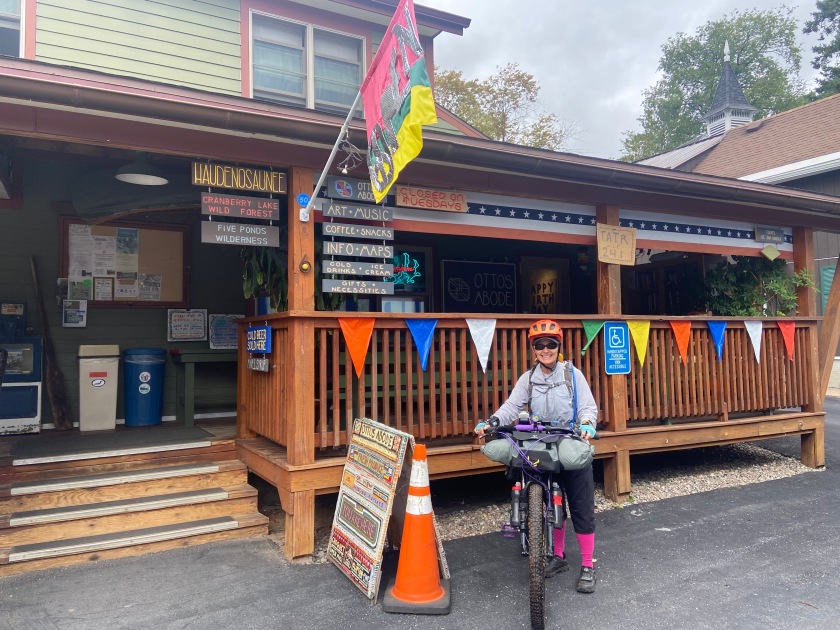
Before starting into the Peavine Swamp, I stop at Otto’s Abode to say hello and have a quick chat with Nolan. I think of Nolan as the mayor of TATR at the Wanakena Outpost. His support of TATR riders is heartwarming.
Otto’s Abode in Wanakena
Trees and mud necessitate some HAB in the Peavine Swamp Trail, and even though the Cranberry 50 is actually more ridable than in past years, there is still ample HAB on this section as well.
After easily making the hairpin turn on the “wall” on the Cranberry 50, HAB of course, I pause to admire my strength in lifting and pushing my bike and all my progress.
As I continue to the end of this section, I find consistent cell coverage so am texting with my daughter-in-law to keep tabs on Mike’s expected finish at any time. The increased cell coverage is a surprise….I do miss being so remote that cell coverage is not an option. Yet, I’m the first one to check to see if there is reception!
I’m all tucked into the Coyote Den when Mike finishes but am able to see him on FaceTime and congratulate him. The first time I’ve ever seen any of his finishes.
That night my hip is the most painful it’s been. All the tough HAB that day has definitely created havoc. I have another night considering whether I’ll call it quits.
Day 8
Then, I’m up and on my way in the dark – the Tooley Pond Road is easy riding in the dark. My hip is fine while riding and I’m hopeful the HAB today will be manageable. It is.
Even the first long uphill stretch into the Tooley Pond Easement is so much improved from past years. No more chunky rocks. Each year I’ve noted the improvements that St. Lawrence County has made on its multi-purpose trails and I’m impressed. Walking that I have to do is because of the steepness but it’s smooth walking. My hip is fine so far with that.
Once on the trail, which they’ve attempted to preclude ATVs from using, I ride most of it. It has been a super wet year so I do have some walks around some massive mud holes, but all are manageable.
The most pleasant surprise is the smooth grade from the trail out to Rt 56. That gravel road has always been jaw-breaking, neck-breaking…. head-pounding. Rocks are now minimal and the grade is smooth!
Once on Stark Road I stop to see Shirley and Deb. In 2017 I tucked into camp along the road late at night. In the early morning hours, I started riding, needing water and wanting coffee. I saw a sign pointing to the left that said “Black Coffee.” As I got closer I saw that it actually read Blakefield Cemetery. Devastated, I rode on until I knocked on Shirley’s door to ask to use a hose for water (lights were on so I knew someone was up!). When I shared my hallucination story she went off to make me a cup of coffee and filled my water bottles. We’ve been friends ever since.
This time I sit in the sun for our visit with Josey, their sweet little dog, giving me lots of love.
Josey!
A break in the sun with friends!
At Lamphere’s Store in Hopkinton, pickings are thin. So I decide to finish off the last bit of a chicken wrap from Star Lake that I had opened early that morning. It doesn’t taste right now so I only eat a little. Off I go to try to make Deer Valley Trails Lodge before dark.
An hour out, abdominal pains start so I back off on the pedaling since I do not want a setback like I had on the Canadian races. I arrive at dark, pick up a turkey dinner I had pre-ordered and head for my room. I sit in front of the space heater –it had turned so cold—and shovel food to the mouth. I still don’t feel right.
At 11 that night I feel so bad I think I should quit. Mile 320 – here I am at the mileage that I scratched on both the BT700 and the LDW. I so wanted to finish at least 1 of these races.
At 1 am I wake up drenched in sweat, shower again and go back to bed thinking I just need a layover day. At 4 am I wake up and realize I ate a bad sandwich that set off my nearly perfect intestinal health for the first time since the surgery. Yahoo, it’s not a physical setback from riding! I just need to sleep a little more and then I’ll ride a short day.
Day 9
I take off mid-to-late morning, realizing how much time on TATR does not matter for me. I had always raced against my own past times, pushing too late into the night, not getting enough sleep and spiraling into 1 poor decision after another. I wish I had approached the Canadian races this way instead of getting sucked into the time and mileage thing.
I feel better and better as the day progresses, and I am grateful as I consistently pedal up more hills that were my past obstacles.
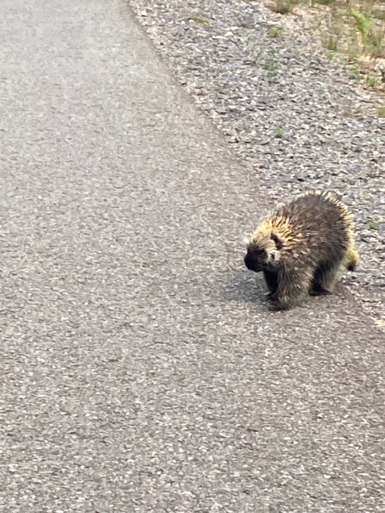
I hit a stretch where I see 1 porcupine after another. When I stop for a picture, this guy waddles closer and then actually charges me. I scream and wildly wave my arms to get him to back off, and I jump back on my bike and pedal away.
I’m only a few miles from Paul Smith as an oncoming rider calls my name. “Who are you?” The mind is so muddled people you know don’t always compute, names are often elusive. This happens even at the finish line when people you know come out to support you. I remember struggling with the names of my friend Michelle and her daughter Emma at my first finish, not fully understanding they were there to cheer me in. Muddled mind!
This is Mike Webster who is in the area with his bike and decided to ride out to meet me. We pedal together to the hot dog man at the RT 30 intersection and chat a little before I take off north—a coke and pop-tarts in hand. Thank you, Mike W!
Mike W.
A break at the Paul Smith lean-to.
I forgot to clean my chain after the dirt sections so I stop again for bike maintenance. I pedal north to Meacham State Park where Shannon Thomarie has come out to ride with me for the evening and into tomorrow.
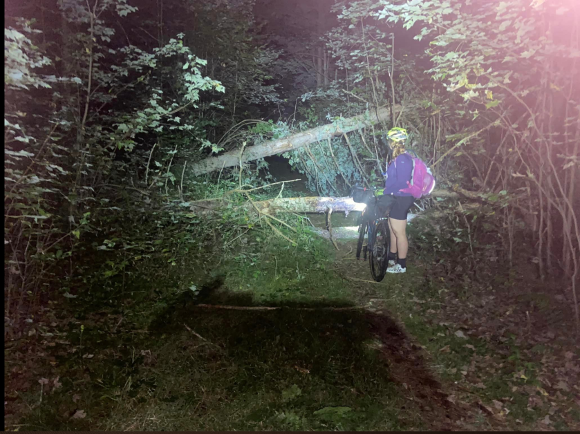
The trail through the Debar Mountain forest is in pretty good shape, despite a giant, downed tree. I think I know the racer who cleared a path through this obstacle! I easily lift my bike, probably only 60 pounds now, up on it and we continue on.
Shannon surveys the situation.
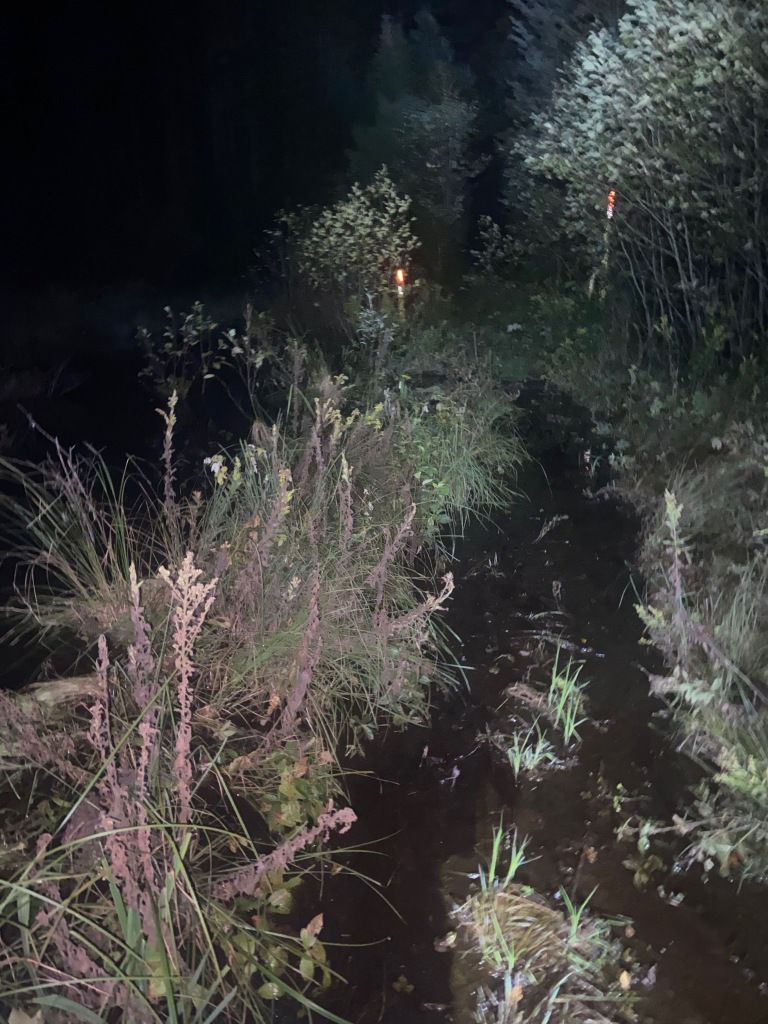
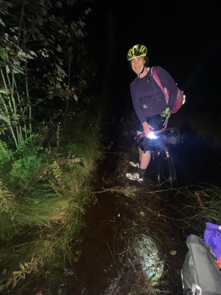
On to the giant beaver pond. Despite laying some tree boughs to support our path, we are soon shin deep and in the dark! A riding partner does make it more tolerable….more memorable in a good way.
Following our traverse through the beaver pond, we eventually camp in Debar Meadows. I bring my soaked insoles into the tent, knowing I will swap them out for my spare insoles in the morning. Always having a dry pair of insoles and riding socks, and a third pair of socks designated only for sleeping, makes all the difference since wet shoes are a given on TATR.
Day 10
We start off fairly early and I continue with my “Quality Miles” program. Today’s epiphany is how much more stable I am on descents than I have ever been before. Only now do I realize how that 50-year adhesion affected my stability for so long. No longer am I descending in Scary Granny mode. I’m going faster because I feel solid and stable. Woohoo!
Always on guard until you see “the why” behind the road closure!
By afternoon, my right leg starts to trigger again. Shannon heads back to her car and I continue to Franklin Falls and up Gillespie Drive. I walk much of the climb up Gillespie, not wanting to risk the full-blown debilitating pattern. For the first time on TATR I am not measuring how much of this crazy climb I do “on” the bike versus “pushing” the bike.
And, for the first time I sense the trigger actually starts in my abdomen and then goes to the leg. I realize that a certain posture on the bike helps the left hip pain but is not so good for the abdomen and right leg. Good beta for my PT back home.
I decide the Poor Man’s Downhill into Wilmington isn’t worth the risk to my current condition, so I go slightly off-course to get to The Cadence, my favorite motel in the village. I wash the bike, resupply and head back to the motel for Food Frenzy #4.
Wilmington
Each motel night I wake up 3-4 times, and each time I get up and do a round of PT. Camping nights, are not so productive. I just can’t stand in the cold dark night and do rounds of PT!
I wonder if my leg and abdomen will take me out of the race. This is the third night I contemplate dropping out. At least I got past mile 320, my stopping point in each of the Canadian races. I’m at mile 400.
Day 11
Feeling better after my PT regimen in the morning, I take off and have a good run down the Three Sisters trail to Hardy Road.
I walk uphill more today to keep everything in check. There are, afterall, 3 significant climbs. I despise climbs designated on my Garmin as 43, 44 & 45 (out of 68 total climbs). Still, I’m in good shape after the climbs up Bartlett, Styles Brook, and Jay Mountain roads. Not sure how my Garmin chooses to profile certain climbs, but in my opinion, there are a number of climbs on TATR that should not be ignored by my Garmin, many more than the 68 it highlights!
At mile 432, I still feel good. This is the point where I’ve gone off-course in past years to stay in a motel in Elizabethtown, just 32 hard miles into the day. But today I am still good. I start my search with spotty cell service for an available motel room in Westport—52 miles for the day-and keep riding.
On Cook Road, I feel my abdomen tighten and my right leg set up to cramp. I back off, walk some, pedal easy. I can’t risk any tension on my right leg as I pedal, so it’s a slow go, these last few miles to The Inn in Westport. I get in well after dark but Anthony is waiting to show me in.
I do my recovery thing and eventually fall asleep.
Day 12
I actually forgo my cappuccino at Jambs in Westport. I haven’t had a single one yet. Instead I grab 2 Gatorades and start pedaling. (Part of the cappuccino problem is that Coffee Fever in Star Lake went out of business – sorely miss that place. Timing with the 2 remaining coffee houses on-route is tough with my riding schedule.)
My TATR history has always included just the right nutritional profile in an attempt to prevent my pain pattern. In past years, I would carry enough of my endurance powder (carbs and protein) for the first half but then mail a package to myself for the second half. It was tricky to plan my mail pick-up since post office hours in the Adirondacks are limited. It was also so heavy, but I thought it was key to keeping my body in check.
Even aside from TATR, I always searched for just the right nutrition and that “key” muscle that a therapist needed to release in order to resolve my issues. But none of that was getting at my core problem – the darn adhesion!
So this year, I brought endurance and recovery powders for only 1 bottle each per day for 6 days—I had high hopes of a fast race in the beginning! (I laugh now when I see my note sheet outlining race paces of 6, 7 and 8 days.) My friend Curt had recommended years ago that I sip something every 5 minutes and eat a bite every 15 minutes.
I’m now relying on a slow constant drip of tiny pieces of a Builder’s Protein Bar stuffed in my cheek (although my toothache has subsided – it was sinuses!), Gartorade to go during the day, and Premier Protein Shakes for recovery that I’ve been finding in many convenience markets.
Aside from a short walk up the punchy start of the Mountain Spring Road, I pedal up the rest of the 4-mile climb. Another milestone for me.
I make a strategic mistake at Grover Hills Deli and eat an entire sandwich for lunch—best to stick to the “slow drip” strategy. Had I arrived just 3 hours earlier, I could have ordered my standard 3 breakfast sandwiches—1 on the handlebars for regular bites; 1 in each front pocket of my magical shirt where they seem to do quite well through the next day.
I continue pedaling up new hills for me and am congratulating myself for such a solid ride on Fairy Lake Road when the steepness just becomes too much! I have several reputable walks and eventually make it to Hogan Hill, Hog’s Back, Old Furnace and Johnson Pond roads—all of which have a molasses feel and seem to take forever. On Johnson Pond Road I anxiously wait for the washed-out chasm that is a tough hike-a-bike (HAB).
Enough time has passed though, that construction has moved along enough to make the passage effortless. Fortunately, I’m after working hours so I make it through without any issues. My fear had been that I’d be prevented from passing and have to backtrack miles out of my way for an alternate route.
I make it to the Blue Ridge Motel, slightly off-route, at dark. My vision of rallying for a big push near the end of the course has just not materialized. I can’t even make it to my destination in daylight.
Day 13
I skip by the North Hudson convenience market to save time, feeling that I have ample food. Too late I remember that my last Snickers bar is gone. I always eat 1 either during the day or when I stop for the night, just to keep enough glucose going to my head. I’m haunted by the time I bonked on this leg of TATR. Not realizing my body had not taken in enough carbohydrates and had plowed through my glycogen stores, I suffered abnormally low blood glucose levels, resulting in “the bonk” and the inability to make sound decisions.
Although I had taken the alternate route around the infamous “Lester Flow” that year, and was on pavement, I make crazy decisions that added so many miles and many feet of climbing to my day. Once my mind started to clear that night with a Table Talk Cherry Pie, all the “decisions” of the day instantly came into focus. I could remember why I made each decision, and how each seemed logical in the moment, but with the sugar pie I saw how absurd my decision-making had been.
The Branch along the Blue Ridge Highway, one of my favorites from back in the day, back in our kayaking days!
The Adirondack Buffalo Company is closed today.
I make every effort to eat carbs and what sweets I have as I pedal up the Blue Ridge Highway. I am opting for the alternate route around Lester Flow, not because of the river level. I don’t have a problem with that so there’s no point in me riding down the trail to look at the water crossing.
It’s the fact that no clearing has been done in Lester this year and I’ve heard about the massive blowdowns that would pose a hazard for my freakishly short legs and inability to clear anything beyond hip height with a bike that weighs more than half of me.
I’ve heard there’s an enormous new blowdown with triple trees on the way to the river. I’m not risking a physical setback at this point. I also make decisions like this considering who will come in to rescue me should I have a problem. I don’t want to put anyone else in jeopardy by taking on too much for me to do independently.
In full disclosure, I also skipped the Sacandaga River crossing on the first day this year, taking the alternate route along Rt 30. Again, it was not the river level. It would be silly from me to ride to the crossing and look across at the guard rail on the far side and say, “Oh, the rail I simply cannot lift my bike over is still there. I don’t see a good samaritan standing by to lift my bike for me.” (One has been there for me in my Sacandaga river crossings in past years.)
I’m not willing to scrape, scratch and sacrifice my titanium bike in an attempt to overcome an obstacle that is beyond me. In addition, drivers on Route 30 have become crazed and I don’t like the danger factor of trying to climb a guardrail onto a skinny shoulder amidst speeding traffic (posing a dangerous situation for all riders). It’s so ironic since I was fine with the water level itself this year.
So, I pedal another mile and a half along the Blue Ridge to the turn-off for the new alternate, which includes 5 miles on the Roosevelt Truck Route. The first half has not seen use and all the scrub is ready to grab at my derailleur, so I walk. It eventually turns to a double-track path/road with a few nice spots for primitive camping.
Then it spills out onto Route 28N, which is a nightmare. Drivers don’t slow, and they don’t move to give any space at all to those riding the narrow shoulder, despite my bright flashing light. It’s dusty and just plain nasty as there are several one-lane stretches due to construction work. The flag folks are concerned for me and repeatedly warn me to be careful with the drivers.
As I try to move along as quickly as possible, I’m aware of my increasingly muddled head and the fact that this exact stretch is where I actually started my bonk that year. I stop again to eat more.
Once I turn off in Minerva, all is well, and my sights are on a can of chicken noodle soup at Sullivan’s Market in Olmsteadville.
Then I barely make it to North Creek and the Stewart’s Shop that is on the new stretch of route. My legs simply feel fried so I stop to drink, eat and charge electronics, even though I plan to take advantage of the Trail Magic cabin offered just 2 miles down the road.
Bean & Jim, competing with the Oswegatchie Center for the top Trail Magic award!
There’s a cabin there, obscured by the sun!
Day 14
Trail Magic amenities have revived me and I’m off to ride Oven Mountain Road where a message urging me on stops me in my tracks because I’m laughing so hard. I end up walking the hill because I need a picture but what a mental boost from ….. who?
One more dirt message and I’m on to Crane Mountain where the mystery is solved. Deb Cioffi pulls up ahead of me and darts out with homemade treats.
Deb grins when I ask if she wrote the messages!
I feel good but know I can’t make the big push from North Creek to home in 1 day. I’ve done it before, but this TATR is about quality miles and not quantity. It would only be a 52-mile day for me, but those are some tough miles.
I almost skip stopping at the Bear Pond Trail Magic house, but the signs they put out directing racers to their driveway are so much fun. I’m so glad I do stop for a few minutes. The lovely couple who does all this are out but they made an amazing sign for me and left a fresh-baked loaf of zucchini bread – of which I immediately eat half.
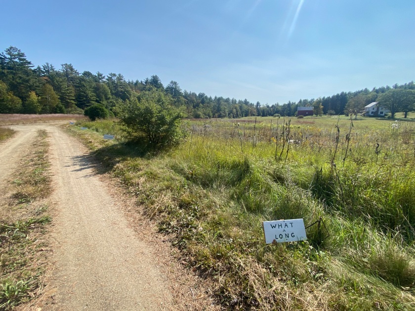
Yes, what a long, strange trip it has been!
On I go to Tucker Road where Shannon appears again with her bike loaded, ready to ride me in to the finish! There’s 1 more washed-out bridge, leaving another crazy chasm to maneuver, and then I’m climbing slow and steady up Harrisburg Road. My walks begin on Wolf Pond Road and then again for the first couple of miles up West Stony Creek Road.
Not an easy crossing.
In no time at all we’re near the start of the Arrow Trail and where I planned to camp, just making daylight! It is the best of my 3 camp spots on this TATR. Beautiful open sky, a bit of moon peeking through and positioned to start the next day fresh on a tough section of the course.
Day 15
We have an “early” start (in my book for this particular race this year—but oh, such a late start in Mike’s book).
The Arrow Trail is actually 1 of the few sections that has become more rideable over the years. The local hunting club has repaired bridges and constructed new ones. It was muddy in places, to be expected since we’ve had an unusually wet season, but it was all easily maneuvered around.
The “misery 1.75 mile” section near the end of the trail is not so full of misery anymore. It’s certainly a HAB section, but the terrain has actually become easier, more forgiving in the 8 years I’ve been riding it. (I actually rode this section before it was included in TATR.)
I have Shannon take a picture in the spot I threw down my sleeping bag in pure exhaustion in 2017 after struggling through a giant blowdown at 5 am for a couple hours of sleep.
Now it’s smooth riding down Harrisburg Rd and onto the East Stony Creek Trail. This trail starts out as a wide double-track, with mud holes created by ATVs. I ride around most of them with just a short walk at times. Once it turns into a single-track hiking trail, more walks are required for me since I don’t yet trust myself maneuvering through the most technical boulder gardens. The bridges are in good shape and I ride up on even the wood walkways in the wet areas that in the past I wouldn’t have touched.
I can easily see the clearing that Dan Remington has done in advance of TATR. It makes a huge difference. Even if you’re walking a section, you’re not pulling your loaded bike up and over logs – a vivid memory for me from 2016. In the sections you’re riding, he’s trimmed branches back so you’re not “grabbed” unaware.
This too is a trail that has become more rideable over the years, in large part due to the clearing that volunteers have done (AKA Dan & Mike).
Tenant Creek Bridge
Tenant Creek bridge is a welcome sight. Less than 2 miles along a dirt path and then it’s the home stretch of pavement. This section of trail has eroded over the years. It swings right to the river bank and in several places the erosion along tree roots will send the unsuspecting rider off the trail, down the bank, right to the East Stony Creek. That’s not an easy climb back up with a bike. I opt to walk a few spots on this otherwise pleasant trail. I expect this erosion has occurred here and not further upstream since there are far more hikers on this stretch than on the trail above Tenant Creek.
It’s all about situational awareness. You need to be aware of your surroundings. You need to be aware of your level of exhaustion. And, you need to be aware of your current judgment capability.
I ride out of the woods to be greeted by cowbells and shouts from Steve and Annette and Jay. Wow! A huge boost to keep me going to the very end.
At 5:17 pm I ride into Waterfront Park, incredibly pleased and so satisfied with my ride. Time doesn’t matter – just realized it took me 14 days, 9 hours and 11 minutes. (Until just now, I thought I had a 13-day time!)
This is just 2 days shy of my initial TATR race in 2016, where I got ever so lost, ever so many times….all because I didn’t know how to zoom in on my ETrex device. But that’s okay since I’ve had no setbacks in my recovery and I’ve gained such great insight about how to proceed with PT. There’s nothing else that could have moved me this far along in recovering from the surgery.
Mike is at the finish with hot soup (and an assortment of food and drink) and Marnie is catching it all on video. Deb is there, Mitzi has driven up from Albany to cheer me in, and Vicki, Dylan and Eileen are there. Ahne, a rider from last year, and Jiri (Yuri), who has ridden the last 3 years, are there.
No emotional choke-up this year for me, just gratitude that I am so happy with my TATR finish and my TATR “career.” Since I’ve finally realized it serves me no purpose to ride against my previous time, I am completely satisfied with my gains and progress.
Never before have I contemplated dropping out at times like I did this year. Granted, course conditions were particularly tough this year. The route though has actually gotten tougher in my opinion. It wasn’t just this year’s wet conditions. Terrain has changed, turning some sections that were challenging rides before into tortuous HABs.
I was out there always thinking, “This is really, really hard.” That makes me all the more grateful that I finished so strong and so happy to have accomplished what I learned were my TATR goals all this time.
While I was drawn to TATR for my first 2 races for the adventure, fun and challenge of it, my purpose changed after I saw significant gains in my bone density once I started riding the race and training for it. It became my annual Osteo-Boot Camp. I used TATR to improve my fitness by trying to improve my time. I never improved my time by much, but I did improve my fitness!
Even this year I originally thought the main purpose was my bone density, but I came to realize out there that I needed TATR as my recovery ride this time. Each race this year has given me great insight on how to continue my recovery.
TATR has served a good purpose for me but looking forward, I feel I can manage both my bone density and continued recovery in other, less intense ways.
Final Tally and Thoughts
Total Miles On Course: at least 5,500
TATR Grand Depart Miles: 4,000 This counts 6 finishes (2016-17, 2019-2021, 2023) & 1 DNF at mile 400 (2018). Notice I’m rounding up from 588 to 600 for each TATR, but it probably all evens out with mileage off-course for services, and getting lost and taking so many wrong turns on TATR #1.
TATR-Lite Miles: 500 A slightly shorter version of the course since I wasn’t quite up to the whole TATR in 2022.
Training Miles on the TATR Course: at least a thousand….maybe more I should have kept track!
People Met On Course: More than I could have imagined.
TATR Stories: I should have kept track!
Someone in Canada this past summer (I think Jen) asked me what I considered the hardest of the 3 races in the St. Lawrence Triple Crown. At that time, I said the Butter Tart – the BT700 – was the hardest for me—I’m not a solid gravel rider, plus at 8 weeks out from surgery I could only ride while seated. Those Canadian courses do have some hills, hills that are spaced in a tough way for me. I made it only to mile 320 (out of 500).
Once I rode the Log Drivers’ Waltz-LDW starting at the end of July (well at least the 320 miles I did out of 500), I still said the BT700 was the hardest. My stability had started to improve, I could coast standing up and I could experiment with pedaling while standing. While I continued to walk ever so many hills, I was starting to learn how to more efficiently approach the hills.
On Day 2 of TATR I thought, “Whatever was I thinking!” TATR is so much harder. Had this race been first in the lineup, I couldn’t have made it through Day 1. The first 55 miles of TATR are considerably rougher and much more arduous than anything I encountered in the first 320 miles of the Canadian races. Also, those first 55 miles comprise only 1 of the TATR tough, tough sections (think Fawn Lake through Perkins Clearing trails, the Moore Trail, Peavine Swamp through the Cranberry 50, and Lester Flow).
I know that both Canadian races get more difficult as the courses continue (so I can’t do a totally fair comparison), and the resupplies on the BT700 & LDW are not spaced as user friendly for me – but that’s purely my issue. I also realize how much my fitness improved after the Canadian races, so my original opinion of the difficulty was certainly shaded by not being very far out from abdominal surgery.
So TATR is, hands down, the toughest. There was a 40% DNF rate this year (7 of 18 racers did not finish). Sometimes it’s a higher DNF rate (with 5 of 6 racers not finishing in 2015) but sometimes it’s a lower rate (with 1 of 8 racers not finishing in 2021).